Friday, November 8, 2024

Garden State Grand Finale

   With the incredible "Indian summer" continuing, I wrapped up my tour of New Jersey's Atlantic coastline with a ride from the city of Perth Amboy down to Atlantic Highlands, where I had started this adventure back in May. Along the way, I would be backtracking a bit on the Henry Hudson Trail, to finish the only segment of that 22.6-mile, crescent-shaped route that I hadn't ridden previously.
   As it turns out, I would have been better avoiding that trail, but it was the most convenient and safest way to skirt Raritan Bay. However, I'm getting ahead of myself.
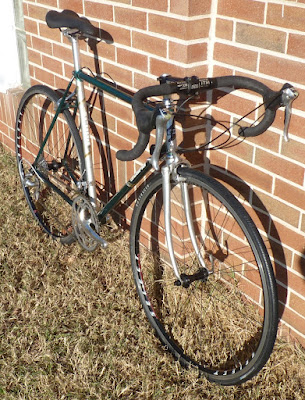
   I again took along my Saeco-Cannondale bike, which I had purchased the day I began this Jersey journey. As I slipped on my cycling shoes at the attractive marina in Perth Amboy, I looked up and was startled by a huge oil tanker charging down the Arthur Kill (the river separating N.J. from Staten Island) into Raritan Bay.
   Perth Amboy was once the capital of the Province of New Jersey, from 1686 to 1776. Its current moniker is a combination of two former names, one being a corruption of the word "Omboge" that the Lenape called the area, and the other was "New Perth", as the 1683 settlement was established by the Scottish. During the area's industrial heyday, Perth Amboy was the marshaling area for Lehigh Valley Railroad hopper cars full of anthracite coal, ready to be loaded onto barges bound for New York City and other ports.
   After years of decline, the city is experiencing a harborside revitalization, taking advantage of its location at the meeting of the Raritan River and Arthur Kill, where the two waterways empty into Raritan Bay. Although a sign marks one of the darker periods of Perth Amboy's history, as New Jersey's primary port for inbound slaves, the marina is now home to one of the oldest yacht clubs in the U.S.

Looking from the point across Arthur Kill to Staten Island

   Because my mom was a fan of his music, I know that Perth Amboy was the birthplace of John Francis Buongiovi, Jr. and his guitarist pal Richard Stephen Sambora. I'm fairly sure they haven't headlined there, but on Sunday summer afternoons, the city hosts Concerts by the Bay at the park bandshell. Thursday evenings are the Mayor's Concert Series, and there is also an annual Waterfront Arts Festival.
   The historic ferry slip that once served as an important way-station for travelers between NYC and Philadelphia has been restored to its 1904 appearance, and a replica ticket office hosts a small museum. 


   I was respectful of the signs asking cyclists not to ride on the marina walkway and instead pedaled along Water Street to the riverside park. I made my way up 2nd Avenue, crossed Market Street and added another train station to my "collection":


    I continued west on Market, instead of the much busier main drag of Smith Street, and eventually met Route 35, and the grueling climb over Victory Bridge into South Amboy. The ascent was made worse by a nasty headwind that I looked forward to enjoying at my back during the return leg! The bike lane on the bridge was a generous ten feet wide, providing a bit of security from what would otherwise be rather intimidating traffic - both in scale and speed.


   At the base of the bridge I turned left on Main Street and passed a monstrosity of a warehouse/distribution center under construction, then headed east on Broadway into the downtown of South Amboy. Although much smaller, the city had the feel of Phoenixville, only with active commuter rail!
   I turned right on Bordentown Avenue, through an attractive neighborhood of clapboard houses that seemed very appropriate to a harbor town, then continued east on Pine Street. I wouldn't necessarily recommend my route as it continued onto NJ-35, but considering it was early afternoon on a weekday and offseason, it wasn't horrible to ride there for just a couple miles.
   Soon after crossing the Cheesequake Creek drawbridge, I made a right turn on Amboy Road and passed through the lovely borough of Keyport. It had all that typical seaport town vibe, and because it was nearing lunch time, I was treated to the aroma of fried food being prepared at some of the waterside restaurants!
   I zigzagged from Front Street over to 3rd Street and follow it to the end, where it intersected the Henry Hudson Trail. I was hoping the conditions had been improved since my last visit to this segment of the trail in 2017, and I did see many spots where buckling had either been scraped down by grading machinery or cut out and paved over. However, the joints weren't perfect, and there were plenty of new areas of damage that gave my body a proper beating!
   The dappled light that was coming through the autumn trees would have made it difficult to spot the badly buckled areas anyway, but the leaves that had fallen added another level of camouflage to the "traps". There wasn't too much to talk about as far as scenery along the trailside, though it may have just been a case of my attention being directed to the asphalt. There were a few pretty crossings over marshland streams on wooden bridges, and a couple of times I was able to look out over the bay for a hazy view of the Manhattan skyline way in the distance.
   When I finally reached my turnaround at Avenue D in the Highlands, I made the quick decision to detour around a large portion of the trail and ride on parallel NJ Route 36 instead. There was a decent shoulder, traffic was fairly light, and most importantly, I wasn't being jostled by poor pavement!
   I took the same diversions through Keyport and South Amboy on my return trip, since I had my fill of riding on busy roads, and as predicted, I greatly enjoyed having the wind push me over the Victory Bridge back to Perth Amboy.


Saturday, October 26, 2024

Giro del Jersey: Stage Seven - Perfection!

   As this incredible stretch of autumn weather has continued, I planned to complete the next section of my New Jersey coast adventure. This time it would be about a 45-mile stretch from Island Beach State Park, north to the borough of Sea Bright, where I had finished the first stage of my journey back in May.
   My plan was to start in the borough of Bay Head, which is the railroad terminus of New Jersey Transit’s Coast Line. I didn’t feel the need to do the complete 90 miles of out-and-back riding, and would take the opportunity to cut off about 18 miles by catching the train in Long Branch and relax on the rails back to my starting point.
   Not that I am complaining too much, but it has been difficult to gauge what clothing is necessary when the mornings start off in the fifties and then climb into the seventies by mid-afternoon. Luckily, when I unloaded my Cannondale (the one I picked up during that Sandy Hook-Sea Bright stage) shortly after 10:00, the temperature had reached the 60s, and because there was no wind (a rarity at the shore), I knew I’d be comfortable in a short-sleeve jersey once I was moving and had warmed up.
   I pedaled off from the Bay Head train station, turned right and was speeding to the south along Ocean Avenue (Route 35). The road was smooth tarmac with a marked bike lane most of the way, down through Mantoloking and a series of named beaches in Brick Township. Here the road split, with each direction being a two-lane one-way street, separated by about a block of houses and businesses. This street arrangement continued for a few miles through the township of Toms River and the boroughs of Lavallette and Seaside Heights.
   It had been nearly forty years since my parents and I took a day trip out to the shore here in order to visit a girlfriend and her family, so I took a little detour just to look at the beach and boardwalk area. Amazingly, with such little wind, the ocean’s gentle waves looked more like those on the Great Lakes than on the Atlantic Ocean! Finding out that I didn't have a whole lot in my memory banks about the neighborhood around Seaside Heights, I promptly veered back onto the adjacent Ocean Terrace and, after a couple of blocks, cut back over to Central Avenue to reach the entrance to Island Beach State Park.
   What a surreal environment this was! Other than a couple park structures, a Coast Guard station and the Governor’s Mansion, the 8.5-mile stretch of poker-straight road was bordered only by dunes, tall grasses and scrub pine. Adding to the strange atmosphere was the complete lack of traffic - I think I was passed by five vehicles during the whole 17 miles of pedaling - and the cloudless blue sky provided a dimensionless background to the stark scenery.

A few clouds lurk in this image borrowed from GoogleMaps, but you get the idea.

   Though there were still many new areas to see today, the actual halfway point of my excursion came on the return back up to Bay Head, and I was stunned to see that Barnegat Bay still looked fairly mirror-like. I was really enjoying cruising along on this breezeless day! I had a few fuel sources in my jersey back pockets, but on this occasion I unwrapped the foil packet and munched on the traditional half of a peanut butter and strawberry jam sandwich that I bring on my longer rides.
   I passed my starting point at Osborne Avenue in Bay Head and continued on into Point Pleasant Beach, where I added another train station to my “collection”:


   I anticipated backing off my pace a bit as I crossed the bridge over the Manasquan River and rode into the attractive downtown area of Sea Girt. My plan was to ride on the boardwalk here, and with the fantastic weather, I knew there would be a good number of people out for a stroll. However, the conditions were SO nice, the majority of the people were actually on the sand, playing paddle games or venturing out to dip their feet in the water.
   I was surprised to find the surface, all the way up through the borough of Spring Lake, was the composite Trex boards and not wood. The boards here were a grayish beige that replicated the weathered wood one might find in Wildwood or Ocean City. The center of the walkway also had a center lane where the boards ran lengthwise, providing a soft, smooth surface for the wheels to glide over. I just wrapped up watching an exciting week of coverage of the track world championships, and I imagined this was what it felt like to ride on a wooden velodrome!
   Into the borough of Belmar, the Trex was a dark, and very attractive, mahogany color. In total there were about 6.5 miles of nearly continuous boardwalk riding, and I had to take one of the short breaks here to cross the drawbridge over the Shark River into Avon-By-The Sea. Now on the more traditional weathered wood, I was soon within sight of the famous Stone Pony music venue in Asbury Park. I had to share this photo I found of Springsteen and a friend on a tandem:


   Finally leaving the boardwalk at Deal Lake, I pedaled into its namesake borough and through Elberon, where the streets were lined with block after block of posh estates! It was obvious that I was now into areas of the New Jersey shore where people lived year-round.
   As I entered Long Branch, the commuter neighborhood feel only increased. While I definitely wouldn’t call this era “urban”, I certainly noticed a greater number of hospitals, schools and businesses – more of the structures to support residents than one would see in communities to the south that sit isolated out on the barrier islands and have mostly summer-oriented populations.
   I soon noted Morris Road, where I would later be making the turn to reach the train station. Moments afterward, I noticed a bank clock and realized I only had a half hour to finish the remaining 8 miles to Sea Bright and return in time to catch the 2:26 train back to Bay Head. Averaging 16 mph for this last segment would be quite an effort after already being in the saddle for sixty miles, but trains only ran every two hours off-peak, and I did not want to miss mine.
   I dug in and made it with just minutes to spare… that is, to wait ten more minutes for the late train! Oh well, better to get (more of) a workout and make sure I caught the train then to end up having to wait around for the next train. Actually, I would have just “sucked it up” and taken on the last 18 miles to ride my bike back. I still had a long drive back to Royersford, and all this pedaling made returning in time for dinner a priority!

   I've had the bicycle listed for a few weeks but somehow managed to forget posting photos of the completed bicycle here. I recently picked up a 2001 Wilier-Triestina Isoard for a bargain price. Painted for that season's Liquigas pro team, the frame is a lightweight composite construction of Easton SC7000 scandium/aluminum and carbon fiber tubes. The bike is built up with an excellent Campagnolo Record Carbon 10-speed group and a set of their Neutron wheels:


   While I'm at it, I'd also like to share photos of the early-1990s Peugeot 1100 Team Line bicycle that I was finally able to complete. I've fortunately sold some bikes and been able to make room for new projects. As planned, the bike has been assembled with mostly French parts, and a full component list can be found on the For Sale page.


Wednesday, October 9, 2024

Not Much To Be Cockey About

   I didn't expect to be returning to complete the lower end of the NCR Trail, officially named the Torrey C. Brown Rail Trail, so soon, but an opportunity to make a bicycle trade with a customer who lives out near Harrisburg provided a reason to head back to York, PA. I had been out through Amish country a couple of times the past few weeks and didn't want to do the same old drive out Route 23 to U.S. 30 again, so I went a little farther south and took smaller state highways across Chester, Lancaster and York counties.
   A little bonus was adding eight more railroad stations to my "collection" along the way, several on the little-known Stewartstown Railroad. Now a tourist railroad, the company was once a freight shortline that connected with the North Central Railway at New Freedom, PA, which was to be the eventual parking location for my ride.
   Four of the stations were still standing along this Maryland section of the NCR, although one at Freeland (photo below) was moved a half mile east (and up a short, nasty hill!) for restoration and use on a farm, and one was at the end of the line, along the abandoned/redeveloped right-of-way in the heart of Cockeysville, MD. I enjoyed seeing town names that became very familiar to me while driving down the Interstate 83 corridor towards Baltimore, on my way back and forth to the University of Maryland. Although, at 34 miles, the two towns were probably a little far apart to be rivals, we imagined Cockeysville and Scaggsville meeting regularly, with the one school waving their index fingers overconfidently and the other knowing they were inferior and expecting defeat.


   The Torry C. Brown Rail Trail runs nearly twenty miles from the state border into Baltimore County through Gunpowder Falls State Park. The route crosses back and forth across the Big Gunpowder Falls River and its many tributaries (Beetree Run, Little Falls, Fourth Mine Branch) innumerable times, as railroad engineers (the route designers, not the locomotive-operating type) strove to reduce curves and cut the straightest possible course along low-lying, meandering waterways. I lost count of the mostly concrete bridges and culverts, and the majority were completely covered by vegetation, making them only discernable by the iron railings or by hearing water rush beneath.
   I started my ride around noon, with a bit of an early autumn chill still in the air, and I didn't expect it to get much warmer along the trail which was mostly under a thick canopy of trees. Leaves were just beginning to fall, and I ended up wishing there were a lot more on the pathway, as it was very rough, compared to the nicely-groomed, finely-crushed gravel of the Heritage Rail Trail. I found it very appropriate that I had just watched the Paris-Tours race that weekend, as its route traverses ten sectors of chemins des vignes, gravely tracks that traverse the vineyards of the Loire Valley.
   The surface was mostly parallel tracks of hard mud, which would would have been fine, but a coarse layer of limestone gravel was imbedded in it, causing mile after mile of pounding vibration through my arms and shoulders. In areas where the surface was looser, it felt like riding over broken concrete! I didn't think it could get worse until I reached a section just north of Monkton, MD, where the trail climbed up above the river into a rock cut. The gravel and dirt was scrubbed clear in patches, and I was riding over bedrock slab! When I was later finishing up the 45-mile out and back route, I honestly felt FAR more fatigued in my upper body than my legs.
   Despite the fact that there was no remaining rail on this portion of the NCR, caretakers of the trail made it clear that this was Pennsylvania Railroad territory, as the wonderfully-restored Monkton Station (photo below) and road crossings (most of which at one time had stations onsite) were all marked with signs in the red and gold company colors and/or keystone motif.


   Besides the station and rural crossings, plus the occasional passerby, there wasn't a whole lot to see except trees and streams. The forest was pretty thick along the whole length of the trail, so there weren't even any scenic vistas to speak about. The peace and quiet was great, but I'd suggest taking along a friend to help pass the time!
   The trail descended 600 feet towards Cockeysville, so the southern direction was far easier, but the ride back wasn't really difficult - as I always say after riding these types of trails, it's a railroad grade, so it can't be too steep or the trains' steel wheels would slip on the steel rails.
   I found that my bike and I were incredibly clean after the ride, especially compared to the coating of light gray dust that covered us after riding the Heritage Rail Trail. I suppose that was the unexpected advantage of riding the punishing, hard-packed gravel surface of the Torrey C. Brown!

   My meet-up in York was to exchange the frameset of my Colnago Extreme Power bicycle for a super-slick Tommasini Sintesi from the early 2000s. I had the Colnago listed for over a year with relatively little interest, so I jumped at the chance to move onto some other project. This is a modern steel frame with a threadless headset, so I am thinking of just swapping in the parts from the Colnago build.
   Here is a shot of the bike as its previous owner had it set up:


As always, more to come...


Monday, September 23, 2024

PUMPING the Pedals Along the IRON Rails

   Cyclists always say, in regard to weight training, “Adding muscle means more to carry up the hills,” but
I wasn’t in York, Pennsylvania, to check out the barbells that have been manufactured there since 1932. I was taking a ride through the Heritage Rail Trail County Park, a true “rails with trail” route that runs 27 miles from the John C. Rudy Park, just north of the city, to the Maryland state line just south of New Freedom, PA.
   While only the first couple miles north out of York and the last ten into New Freedom are active, railroad tracks run parallel to the trail the whole length of the route. In fact, the trail crosses back and forth many times over the tracks in order to take advantage of space along the right-of-way, as there are several rock cuts and bridges on the route that needed to be considered when laying down the mostly cinder path.
   The history of this route involved the North Central Railway, a subsidiary of the Pennsylvania Railroad. The NCRY was an important supply line for the Union Army during the Civil War, and famously Abraham Lincoln traveled the railroad and switched trains at Hanover Junction (photo below) on his way to deliver his Gettysburg Address in November of 1863. Sadly, after his assassination, the president’s body travelled the same rails on the way from Washington, D.C., to Springfield, Illinois. The modern day Northern Central Railway of York operates as a tourist train between New Freedom and Hanover Junction, often running behind a replica of a Civil War-era steam locomotive.


   Most of the first four miles of the trail, from the large sports complex at Rudy Park to the bridge at Route 30 is paved, then the trail climbs a gentle switchback in order to cross the bridge over to the west bank of Codorus Creek. The trail runs atop the levee into downtown York, eventually crossing back over the creek at the George Street Bridge, right near WellSpan Park, home of minor league baseball’s York Revolution.

Some of the pleasant scenery just north of the Rt. 30 bridge

   I have to admit that the trail wasn’t particularly well-marked at the turn onto the bridge. Even though I had done some preliminary recon of the route online, I could see how someone new to the area could be confused about exactly where the trail goes at George Street.
   Now following the east bank of the creek, the trail crosses a few busy streets, and I was disappointed that most did not have a signal of any kind, leaving walkers and cyclists to fend for themselves against the traffic. When I was safely out of the city, the trail became a nicely-shaded path, and I was able to increase my pace.
   During some stretches out in the woods there wasn’t too much to see, but before too long I reached Brillhart Station (below), one of a handful of railroad structures still standing by the trail. During this ride I pushed my total to 703 railroad stations that I’ve “collected” all over the U.S.


   About a mile and a half later I passed through Howard Tunnel. Opened to rail traffic in 1838, the 275-feet-long, brick-lined structure is the second oldest active rail tunnel in the country:


   The trail had been following the south branch of Codorus Creek since leaving York, and it had been very gently climbing through the borough of Seven Valleys. Here was the headquarters for American Railbike Adventures, which was a bit of a misnomer, as “bi-” implies two wheels. These were more of a pedaling railcar, but I can see how that doesn’t quite roll off the tongue. In any case, the site featured self-propelled machines that can be used to explore an abandoned rail line. It was interesting to see that these vehicles could go off individually or be coupled together to form an actual train of railcars.


   After passing Hanover Junction and the borough of Glen Rock, the incline becomes noticeably steeper, though covering about 300 feet of elevation in five miles isn’t exactly unbearable to even the most casual cyclist! Soon I pedaled through the pretty little borough of (appropriately named) Railroad and was in the outskirts of New Freedom.
   The various railroad cars and locomotives on the storage tracks around the station (below) made it obvious this was the hub of the tourist railroad. About the size of Royersford, the borough was the longtime home of Summers Canning, now part of the Hanover Foods Corporation.


   A few blocks later, I reached the 880-foot summit of the ridge, just before the Mason-Dixon Line. This would be my turnaround point, though the NCR Trail (officially known as the Torry C. Brown Trail) does continue for another twenty miles into Maryland. Leaving that segment for another trip, I enjoyed a speedy descent, which involved a good amount of coasting, back towards York.


Friday, September 6, 2024

Giro del Jersey: Bonus Stage or Queen Stage?

   The queen stage of a multi-day bicycle race is traditionally the most difficult. That day's route usually involves the most mountains, but when talking about the Jersey shore, the bridges are the only challenging gain in elevation!
   In this case the real test would be the distance of the stage, as I was doing an unplanned (Giro-wise) ride from Stone Harbor, almost all the way home to Royersford. To avoid having to do the full 114 miles, my intent was to pedal the 81 miles to Temple University's Septa Station and take the regional rail train to Norristown, cutting out nearly 17 miles of cycling to make my day's final total of 97.
   I knew I was really in for a tough task, as by this time in the summer I would usually have done a handful of 63-mile (metric century) rides and maybe even another 100-miler, but the extreme heat this summer has had me doing consistently shorter distances of 30-50. I may have done these sessions at a higher intensity, but the necessary length of time in the saddle was definitely not part of my training.
   The reason for taking on this route was our annual family "Seafood Fest" and the idea that Sue might need to give one of our other relatives a ride home. Faced with crowding three people and our stuff into our Honda Fit, I decided to bring my Cannondale down with us and make my way home on my own. The weather forecast had called for dry, sunny weather with reasonable temperatures, so I was rather excited by the prospect!
   I had plotted out on my queue sheet the same route (only in reverse) that I had done back in 2016, when I rode from Philadelphia to the shore. I modified my course slightly by, instead of heading out the Stone Harbor causeway and turning north to connect Route 9 to Route 50, cutting out some mileage with a ride up through Avalon, out the causeway there and taking some back roads up to meet 50 in Tuckahoe.
   It was humid in the morning, as it always is at the shore, and I was sweating profusely, so I made sure to replenish fluids early in the ride. I decided to stop at the Tuckahoe Bike Shop for water refills and to wipe off my sweat-dripped sunglass lenses. I had an amusing incident there, when an impatient customer tired of waiting for service and asked me some questions about bicycle fitting. There was no way he could know that I actually had experience with providing customers properly-sized bicycles, but maybe I just had a look about me that I may know a thing or two?
   The air was getting noticeably dryer as I moved inland, and I enjoyed the advantage of starting out in the morning, when the sun was at a lower angle, and the trees lining the roads provided plenty of shade. I was well-fueled along the way, with a couple fruit/nut bars, a half of a peanut butter and jelly sandwich made on Sue's wonderful homemade gluten-free cheesy bread and some packages of "Sport Beans", essentially an electrolyte/vitamin-fortified candy.
   Just outside of Mays Landing, I veered west around Lake Lenape on Weymouth Road, and I was soon about half-way to Philadelphia when I reached U.S. Route 322. I suppose most people wouldn't enjoy riding on this four-lane, undivided highway, but it was an early Monday afternoon, so traffic was relatively light, and the road shoulder is super-wide, so you can stay safely away from the driving lane.
   I was moving along at a good clip - holding around 17 mph - and became very aware of some monotonous stretches of straight road. A particularly boring slog was the section between Weymouth and Blue Anchor, where except for a slight right-hand turn onto Mays Landing Road (Rt. 73) and a long bend at the interchange with the Atlantic City Expressway, the streets were poker-straight for 14 miles!
   There were a sufficient number of Wawa stores along the way, where I could refill my water bottles (I went through about eight), but the best spot was Mr. Bill's in Winslow Township. The huge, Alfred E. Neuman-like statue is a well-known landmark for the restaurant. The young woman there filled a large cup with water and ice, and after I distributed the frozen cubes between my two bottles, I was treated to an hour or so of wonderfully cool sips!


   After a left on Blue Anchor Road and an eventual right on Erial Road, I was heading toward the only real hilly area in this part of New Jersey, appropriately called Pine Hill. It actually was a pleasure to use some different leg muscles for a few minutes.
   Near Clementon Park I hooked up with Atlantic Avenue, which parallels the old Pennsylvania-Reading Seashore Lines railroad grade. A few nicely-maintained passenger stations still stand along the route, breaking up another stretch of about 10 miles of relatively straight road. 


   I had mixed feelings about someone pulling up next to me on Route 30, hitting a water-filled pothole and giving me a good soaking. It was startling and unpleasant at first, but because the water was runoff from a nearby car wash, at least it was fairly clean, and as I pedaled along and was drying out, the evaporation on my skin and clothes felt fantastic!
   The definite lowlight of the trip was the last couple of miles into Camden on Haddon Avenue, as the surface was old concrete slab with very badly-repaired joints. Every ten feet or so was an abusive blow to my arms and shoulders, as the shock transferred directly up my handlebars. I didn't remember it being so bad during previous trips the other direction, and I glanced across the road to notice the eastbound lane did indeed appear to be in better condition. Perhaps people are being encouraged to head out of Camden, instead of into the city?
   The new bicycle ramp connection to the Ben Franklin Bridge at 5th Street near the Rutgers-Camden University campus, where one was previously required to haul a bike up a flight of stairs, was wonderful. However, with over 70 miles of pedaling already in my legs, I became accutely aware of the steepness of the bridge climb, not only the incline necessary to provide 135 feet of clearance over the Delaware River, but also the additional 15 feet or so to clear the PATCO train tracks that run across the bridge, below the walkway surface.


   At the base of the bridge, I used the sidewalk crossings to safely negotiate my way over to 7th Street, so I could work my way north the last couple miles of this part of my journey. At Berks Street, I again took to the sidewalk for a brief shortcut against the one-way flow of traffic to meet the station at Temple.
   I really appreciated the mileage that the trainride helped me to avoid out to Norristown, but in the long run, the half-hour off of the bike was not great for my body or my morale. I was sweating heavily and wanted to replenish my fluids, but my water supply timing was poor at this point, and I had to wait until I reached a refill spot along the Schuylkill, between Norristown and Valley Forge.
   Bicycle racing commentators always say, "If you are feeling thirsty, it's too late," and I was definitely making a case for this statement. I was TOAST - that last sixteen miles was brutal! I enjoyed the pleasant shade through the well-known "tree tunnel" at Valley Forge, but think I was in a daze through Phoenixville, because I don't remember the nasty climb up to Fillmore Street at all.

  ...and the only reason I recall heading up Main Street in Royersford - the slowest I've ever done that ascent - was because I was looking forward to a supply of Italian ice I knew was in our home freezer!


Wednesday, August 21, 2024

Giro del Jersey: Stage 5 - Long Beach Island

   I knew that this middle segment was going to be a bit of a drag, not because the pan-flat route of 18 miles in each direction would be particularly challenging, but because it is in a much more isolated location than the other segments. Long Beach Island is separated from Brigantine to the south by 9 miles of wetlands and the Jacques Cousteau National Estuary, and to the north by the inlet to Barnegat Bay.
   There is only one way onto the barrier island, about 6.5 miles out Route 72 from the Garden State Parkway and out the causeway and bridges. Instead of making the trip by myself, I invited Sue to come along during one of our stays at her family’s shore house in Stone Harbor.
   Back when we were young adults, Sue and I would visit Brant Beach on L.B.I., when there were big summer multi-family get-togethers at a friend’s house there. Thirty years on, we doubted we could even remember where that house was!
   We parked in Ship Bottom Township, just a couple blocks north of Route 72 near Jacobsen Elementary School, and headed south on the island along Barnegat Avenue. The road surface was decent here, and the traffic was typical of a secondary shore road, but after about a dozen blocks, we were forced onto the very busy Long Beach Boulevard.
   Luckily this only lasted a few dangerous blocks, as we turned left to reach the much more pleasant Ocean Boulevard. We found it interesting that sidewalks were not common on the island, so instead there were marked walking/cycling lanes. We appreciated that there were also signs directing pedestrians to walk (properly) against traffic direction, which makes them much more aware of cyclists!


   One small concern was that, because there is very little grass at the shore, many folks’ pea gravel “lawns” were migrating a bit out onto the asphalt, cyclists with narrow tires need to beware of possible pinch flats. There were relatively few people crossing the street to head to the beach on a Thursday afternoon, so were zipping along without much interruption.
   Although the street name changed to Beach Avenue just outside of Long Beach Township, and the walking lane was now bordered by a single white stripe, the riding conditions were pretty much the same. We only encountered the occasional jogger and one or two leisurely bike riders, as the road doglegged to the right, at the area where the island widened a bit to allow for three parallel streets.
   Not wanting to repeat the same route down and back, we remained on Beach Avenue instead of riding on Atlantic Avenue to the east, and we noticed the homes were now more of the older, Victorian style as we neared Beach Haven. At the borough line we were delighted to find the two aforementioned roads became one way in each direction, allowing for the widening of the bike lane, with broad green painted markings at each intersection.


   Atlantic Avenue ended about two miles from the end of the island, so traffic was again bi-directional, and we were soon diverted onto the boulevard again, but traffic was very light this far from the end of the line! The asphalt was a bit more worn in some sections this far south, probably just suffering from less road crew attention.
   We took a brief look out over South Beach and the Edwin B. Forsythe National Wildlife Refuge, just to see Brigantine and Atlantic City way in the distance, then turned around to enjoy the windward leg north. The one-way riding on Atlantic was very similar to that on its parallel sister road, though we had noticeably more cycling company.
   At one point we passed a young man on a hybrid bike, and a few miles later he pulled up alongside us at an intersection. He commented to my wife about the pace we were doing and his struggle to keep up, and my wife mentioned how she was actually holding me back. A little while later, when we returned through Ship Bottom and were zig-zagging off of the busy boulevard over to Central Avenue, we noticed our buddy was still back there a bit, trying to keep up.
   Sue rode with me through Surf City,“Where it’s two to one” (look it up, if you aren’t a fan of Jan and Dean or the Ramones), then decided not to push it, since her back had been tightening up. There was a nice row of shade trees on the school lawn near our car, so she had plans to roll out a towel for a nap while I continued on.
   Central Avenue merged with the boulevard, but at this point the busy route was a pleasant four-lane road with a grassy median separating the two directions and welcoming, wide shoulder for bicycle travel. As I neared the borough of Harvey Cedars, I noticed that many residents had unique mailboxes or markers adjacent to their driveways, perhaps to better show visitors their property location? Some were more elaborate than others:


   There wasn’t too much to highlight the remaining four miles or so out to Barnegat Lighthouse, as the boulevard became a four-lane undivided highway. A decent shoulder still remained, though the traffic was very light. The size of the road actually seemed rather silly, but I’ve heard that Saturday mornings, when the rental cycle turns over, can be hectic, and I’m sure during evacuation situations the two lanes are much needed!
   I rode out to Barnegat Lighthouse State Park to catch a close-up view of the 172-foot structure, which was built in 1879:


   Heading back, I had to laugh when, about a mile back south down Long Beach Boulevard, I saw our tag-along buddy still grinding his pedals towards the lighthouse. I made sure to give him an enthusiastic wave!


Tuesday, August 6, 2024

Abel To Take On the Knox and Kane

   Years ago my wife had read about a tornado taking out one of the tallest railroad trestles in the world, the Kinzua Viaduct just north of Kane, PA. Being a railfan, I had known about a tourist railroad that once traversed this impressivestructure, but it wasn't something I was even remotely interested in checking out.
   It is a bit of an understatement to say that I am not big fan of heights, and I generally avoid ladders, exposed elevators, ferris wheels - anything that doesn't have a solid, earthbound floor. I don't have a real problem with scenic overlooks, but you defintely won't catch me dangling my feet over the edge of a cliff!
   Anyway, a tourist attraction has been made of the few remaining support towers of the bridge, about 600 feet long, complete with a viewing deck 300 feet above the creek valley. Since the viaduct was right around the corner from Pine Creek, Sue immediately worked a visit to the structure into our "PA Wilds" vacation itinerary. The Knox and Kane Trail, which was built on the former railroad bed, was an added bonus!
   Before ending up there, we stopped in the small town of Galeton, to see the Larimer and Norton lumber facility. I'm not sure if it was just a slow period, or if the site had been abandoned, but there weren't any employees around and the yard was rather empty of vehicles and logs. The company used to supply billets of white ash for Louisville Slugger baseball bats, but most pro players have switched to maple.

   We also took close-up photos of the warehouse and office signs:


   We also visited the borough of Coudersport to see their really impressive station, especially considering the small size of the Coudersport and Port Allegany Railroad. My "collection" of railroad stations visited and photographed all over the country is nearing 700!


   Upon our arrival to the impressive Kinzua Viaduct visitors center, we found out the collapsed structure was actually the second built on this site, erected in 1900 to accommodate the heavier locomotives of the time. The original bridge was built in 1882 by the Phoenix Iron Works, which was located just a few miles down the Schuylkill River from Royersford, in Phoenixville. The original bridge was constructed of patented hollow iron tubes called "Phoenix Columns"!

The viaduct before it was struck by a tornado in 2003, when 11 of the 20 towers collapsed.

   As we walked out to the viewing platform, I considered playing it safe by walking down the middle, but I found out you could see down through between the ties holding the simulated tracks in place, and I quickly jumped over to the solid walkway! I was actually enjoying the scenery out to the horizon on each side, but when my view dropped to the trees below, and the wind was moving the leaves, I started to get a little woozy. At the platform, I grabbed the handrail and fixed my eyes on objects that weren't moving!


   Little kids were jumping on the glass floor of the platform, and I kept thinking, "When it cracks and they fall through, they'll be sorry!"


   We were staying in a nice-sized apartment in downtown Kane, with easy access to the trail, which will eventually be a full length of about seventy-four miles. At this point the route is in three disconnected sections of about forty-eight miles, and the next day we set off to explore the middle portion, which stretches to the southeast about twelve miles to the community of De Young.
   The trailhead is on U.S. Route 6, right at the former Kane station (photo below) for the Knox and Cane Railroad, and in a couple hundred yards we reached a wye, where the trail branches off to the east or to the south. We veered to the right and headed through a residential neighborhood and past Kane High School campus.


   It was a bit warmer this day than we had experienced at Pine Creek, but there was still very low humidity, and the trail was nicely shaded nearly the whole length by a thick canopy of trees. The trail ended, rather unceremoniously at a dirt drive in someone's back yard, and we simply turned around.
   There wasn't a whole lot to see out in the middle of nowhere, but there were a good number of crossings at small roads and dirt driveways. We thought the access gates that marked these crossings were a bit narrow than they needed to be, and we imagined some lesser-experienced bicycle riders might have problems, especially if they had wider, mountain bike-type bars.


   Sure enough, on our return trip, we were closing in one of these barriers with a pair of older women in front of us on cruiser bikes. One of them came to an awkward, swerving stop when she panicked that she wouldn't fit through the gate. They apologized sweetly for holding us up and let us slip by on our way.
   At the wye we turned east from Kane and soon reached an old wooden trestle (photo below) that stretched across a low spot next to the highway. Unfortunately, the structure was currently closed to cyclists, and posted signs directed trail-users to use the parallel road. Soon after the short detour, we were pedaling into some open areas with nice views of farmland.


   Soon we were riding through the Kane Country Club. Although I felt rather safe from where I snapped the photo below, there were a couple spots that paralleled fairways, and one section of the trail actually cut right across between the tee and green. I not only wondered if anyone had been bonked by a golf ball, but also if there was anywhere else in the country with this strange arrangement.

Note the green and golfers putting behind the trees on the right.

   At the crossing with U.S. Route 6, we reached the “official” end of this section, as the there was a sign informing users of the current contractor for construction towards Lantz Corners. We could see that the clay base with fine cinders was in place, but the finishing top layer of crushed stone had not been spread.
   There were some bicycle tire tracks, so I thought later in the week I might investigate how far work had been completed. For this day, we had done plenty of distance, and still faced the return to Kane.

   After Sunday's shaky weather, we were considering where to ride, but being rather tired of loading/unloading our bikes from the car, we decided to pass on driving out to the lower twenty-eight miles of the trail, between the communities of Marienville and Marianne. We opted to do our own individual routes, with Sue checking out some of the rural (and rather hilly, she found out) roads around Kane and me heading out the fifteen miles or so back to the Kinzua Viaduct.
   It was a bit warmer Monday, which contributed to the weariness I felt when I reached the little uphill at the eastbound leg of the wye near the Kane Station. I pedaled through the fatigue and eventually settled into a good rhythm through scenery familiar from our previous ride.
   This time I carefully continued across Route 6 and headed into the section of the trail still under construction. Sadly, it only lasted about a mile, and the trail dead-ended at a farm fence. I rode along the fence line and used the farm driveway to reach West Brick Road, which ran parallel to Route 6 for about a half mile. I was having a bit of Tour of Flanders feel, though I knew the cobbles in De Ronde weren’t anywhere near as smooth as these red brick pavers!


   Alas, the fun ended, and I had to return to the highway. Although having cars buzz by at high speed is slightly intimidating, Route 6 is Pennsylvania Bike Route Y, and it has a nice, wide shoulder in good condition. I soon rolled into Lantz Corners, veered left briefly onto U.S. Route 219 and connected again with the trail.
   The path was steadily climbing up to Mt. Jewett, and I had hit it a bit too hard, as pro racers say “going into the red”. I laughed to myself, since I was literally* in red, wearing my late-1950s Faema-Learco Guerra throwback jersey (that squad had legends like Charley Gaul and Rik van Looy).

*Note, this is the CORRECT usage of the word “literally”, which currently has to be the most overly- and incorrectly-used word in the English language!

   I dropped down to a lower gear and spun for a few minutes of recovery before hearing a locomotive horn. I was surprised to see a BNSF Railway locomotive leading a passing train on the parallel Buffalo and Pittsburgh line (more trackage belonging to the Genessee and Wyoming system). Burlington Northern and Santa Fe was a ‘90s railroad merger of two national giants, but you may be wondering why a locomotive from a predominantly western company is on a Pennyslvania train.
   Today’s modern railroading features the pooling of locomotives across the country, so that power is always available for trains connecting routes through hubs like Chicago or Cincinnati. Pooling power also eliminates the time wasted to switch out locomotives from trains that are travelling intact from coast to coast.
   As expected, the trail crested in Mt. Jewett, and I ratcheted up the pace for the descent to Kinzua Bridge State Park. I had a brief conversation with a little boy who was checking out the viaduct with his family before turning around for the climb back up to Mt. Jewett.
   After miles of enduring the vibration over the gravel, my hands and arms were appreciating the smooth pavement when I eventually returned to Route 6. However, I was soon buffeted by a lumber truck going by at 55 mph, and I not only remembered the serenity of secluded trails in the woods but also the safety of those paths, away from aggressive and/or distracted drivers!