
It is a bit of an understatement to say that I am not big fan of heights, and I generally avoid ladders, exposed elevators, ferris wheels - anything that doesn't have a solid, earthbound floor. I don't have a real problem with scenic overlooks, but you defintely won't catch me dangling my feet over the edge of a cliff!
Anyway, a tourist attraction has been made of the few remaining support towers of the bridge, about 600 feet long, complete with a viewing deck 300 feet above the creek valley. Since the viaduct was right around the corner from Pine Creek, Sue immediately worked a visit to the structure into our "PA Wilds" vacation itinerary. The Knox and Kane Trail, which was built on the former railroad bed, was an added bonus!
Before ending up there, we stopped in the small town of Galeton, to see the Larimer and Norton lumber facility. I'm not sure if it was just a slow period, or if the site had been abandoned, but there weren't any employees around and the yard was rather empty of vehicles and logs. The company used to supply billets of white ash for Louisville Slugger baseball bats, but most pro players have switched to maple.


.JPG)
We also visited the borough of Coudersport to see their really impressive station, especially considering the small size of the Coudersport and Port Allegany Railroad. My "collection" of railroad stations visited and photographed all over the country is nearing 700!

Upon our arrival to the impressive Kinzua Viaduct visitors center, we found out the collapsed structure was actually the second built on this site, erected in 1900 to accommodate the heavier locomotives of the time. The original bridge was built in 1882 by the Phoenix Iron Works, which was located just a few miles down the Schuylkill River from Royersford, in Phoenixville. The original bridge was constructed of patented hollow iron tubes called "Phoenix Columns"!


.JPG)

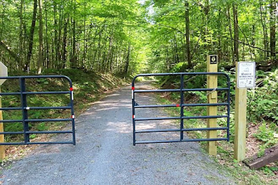
Sure enough, on our return trip, we were closing in one of these barriers with a pair of older women in front of us on cruiser bikes. One of them came to an awkward, swerving stop when she panicked that she wouldn't fit through the gate. They apologized sweetly for holding us up and let us slip by on our way.
 |
| The viaduct before it was struck by a tornado in 2003, when 11 of the 20 towers collapsed. |
As we walked out to the viewing platform, I considered playing it safe by walking down the middle, but I found out you could see down through between the ties holding the simulated tracks in place, and I quickly jumped over to the solid walkway! I was actually enjoying the scenery out to the horizon on each side, but when my view dropped to the trees below, and the wind was moving the leaves, I started to get a little woozy. At the platform, I grabbed the handrail and fixed my eyes on objects that weren't moving!

Little kids were jumping on the glass floor of the platform, and I kept thinking, "When it cracks and they fall through, they'll be sorry!"

.JPG)
We were staying in a nice-sized apartment in downtown Kane, with easy access to the trail, which will eventually be a full length of about seventy-four miles. At this point the route is in three disconnected sections of about forty-eight miles, and the next day we set off to explore the middle portion, which stretches to the southeast about twelve miles to the community of De Young.
The trailhead is on U.S. Route 6, right at the former Kane station (photo below) for the Knox and Cane Railroad, and in a couple hundred yards we reached a wye, where the trail branches off to the east or to the south. We veered to the right and headed through a residential neighborhood and past Kane High School campus.

It was a bit warmer this day than we had experienced at Pine Creek, but there was still very low humidity, and the trail was nicely shaded nearly the whole length by a thick canopy of trees. The trail ended, rather unceremoniously at a dirt drive in someone's back yard, and we simply turned around.
There wasn't a whole lot to see out in the middle of nowhere, but there were a good number of crossings at small roads and dirt driveways. We thought the access gates that marked these crossings were a bit narrow than they needed to be, and we imagined some lesser-experienced bicycle riders might have problems, especially if they had wider, mountain bike-type bars.

At the wye we turned east from Kane and soon reached an old wooden trestle (photo below) that stretched across a low spot next to the highway. Unfortunately, the structure was currently closed to cyclists, and posted signs directed trail-users to use the parallel road. Soon after the short detour, we were pedaling into some open areas with nice views of farmland.

Soon we were riding through the Kane Country Club. Although I felt rather safe from where I snapped the photo below, there were a couple spots that paralleled fairways, and one section of the trail actually cut right across between the tee and green. I not only wondered if anyone had been bonked by a golf ball, but also if there was anywhere else in the country with this strange arrangement.
 |
| Note the green and golfers putting behind the trees on the right. |
There were some bicycle tire tracks, so I thought later in the week I might investigate how far work had been completed. For this day, we had done plenty of distance, and still faced the return to Kane.
After Sunday's shaky weather, we were considering where to ride, but being rather tired of loading/unloading our bikes from the car, we decided to pass on driving out to the lower twenty-eight miles of the trail, between the communities of Marienville and Marianne. We opted to do our own individual routes, with Sue checking out some of the rural (and rather hilly, she found out) roads around Kane and me heading out the fifteen miles or so back to the Kinzua Viaduct.
It was a bit warmer Monday, which contributed to the weariness I felt when I reached the little uphill at the eastbound leg of the wye near the Kane Station. I pedaled through the fatigue and eventually settled into a good rhythm through scenery familiar from our previous ride.
This time I carefully continued across Route 6 and headed into the section of the trail still under construction. Sadly, it only lasted about a mile, and the trail dead-ended at a farm fence. I rode along the fence line and used the farm driveway to reach West Brick Road, which ran parallel to Route 6 for about a half mile. I was having a bit of Tour of Flanders feel, though I knew the cobbles in De Ronde weren’t anywhere near as smooth as these red brick pavers!

Alas, the fun ended, and I had to return to the highway. Although having cars buzz by at high speed is slightly intimidating, Route 6 is Pennsylvania Bike Route Y, and it has a nice, wide shoulder in good condition. I soon rolled into Lantz Corners, veered left briefly onto U.S. Route 219 and connected again with the trail.
The path was steadily climbing up to Mt. Jewett, and I had hit it a bit too hard, as pro racers say “going into the red”. I laughed to myself, since I was literally* in red, wearing my late-1950s Faema-Learco Guerra throwback jersey (that squad had legends like Charley Gaul and Rik van Looy).
*Note, this is the CORRECT usage of the word “literally”, which currently has to be the most overly- and incorrectly-used word in the English language!

Today’s modern railroading features the pooling of locomotives across the country, so that power is always available for trains connecting routes through hubs like Chicago or Cincinnati. Pooling power also eliminates the time wasted to switch out locomotives from trains that are travelling intact from coast to coast.
As expected, the trail crested in Mt. Jewett, and I ratcheted up the pace for the descent to Kinzua Bridge State Park. I had a brief conversation with a little boy who was checking out the viaduct with his family before turning around for the climb back up to Mt. Jewett.
After miles of enduring the vibration over the gravel, my hands and arms were appreciating the smooth pavement when I eventually returned to Route 6. However, I was soon buffeted by a lumber truck going by at 55 mph, and I not only remembered the serenity of secluded trails in the woods but also the safety of those paths, away from aggressive and/or distracted drivers!
No comments :
Post a Comment