There is only one way onto the barrier island, about 6.5 miles out Route 72 from the Garden State Parkway and out the causeway and bridges. Instead of making the trip by myself, I invited Sue to come along during one of our stays at her family’s shore house in Stone Harbor.
Back when we were young adults, Sue and I would visit Brant Beach on L.B.I., when there were big summer multi-family get-togethers at a friend’s house there. Thirty years on, we doubted we could even remember where that house was!
We parked in Ship Bottom Township, just a couple blocks north of Route 72 near Jacobsen Elementary School, and headed south on the island along Barnegat Avenue. The road surface was decent here, and the traffic was typical of a secondary shore road, but after about a dozen blocks, we were forced onto the very busy Long Beach Boulevard.
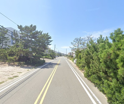
Luckily this only lasted a few dangerous blocks, as we turned left to reach the much more pleasant Ocean Boulevard. We found it interesting that sidewalks were not common on the island, so instead there were marked walking/cycling lanes. We appreciated that there were also signs directing pedestrians to walk (properly) against traffic direction, which makes them much more aware of cyclists!
One small concern was that, because there is very little grass at the shore, many folks’ pea gravel “lawns” were migrating a bit out onto the asphalt. Cyclists with narrow tires needed to beware of possible pinch flats from riding over the stray stones. There were relatively few people crossing the street to head to the beach on a Thursday afternoon, so we were zipping along without much interruption.
Although the street name changed to Beach Avenue just outside of Long Beach Township, and the walking lane was now bordered by a single white stripe, the riding conditions were pretty much the same. We only encountered the occasional jogger and one or two leisurely bike riders, as the road doglegged to the right, at the area where the island widened a bit to allow for three parallel streets.
Not wanting to repeat the same route down and back, we remained on Beach Avenue instead of riding on Atlantic Avenue to the east, and we noticed the homes were now more of the older, Victorian style as we neared Beach Haven. At the borough line we were delighted to find the two aforementioned roads became one way in each direction, allowing for the widening of the bike lane, with broad green painted markings at each intersection.
Atlantic Avenue ended about two miles from the end of the island, so traffic was again bi-directional, and we were soon diverted onto the boulevard again, but traffic was very light way out here at the end of the island! The asphalt was a bit more worn in some sections this far south, probably just suffering from less road crew attention.
We took a brief look out over South Beach and the Edwin B. Forsythe National Wildlife Refuge, just to see Brigantine and Atlantic City way in the distance, then turned around to enjoy the windward leg north. The one-way riding on Atlantic was very similar to that on its parallel sister road, though we had noticeably more cycling company.
At one point we passed a young man on a hybrid bike, and a few miles later he pulled up alongside us at an intersection. He commented to my wife about the pace we were doing and his struggle to keep up, and my wife mentioned how she was actually holding me back. A little while later, when we returned through Ship Bottom and were zig-zagging off of the busy boulevard over to Central Avenue, we noticed our buddy was still back there a bit, trying to keep up.
Sue rode with me through Surf City,“Where it’s two to one” (look it up, if you aren’t a fan of Jan and Dean or the Ramones), then decided not to push it, since her back had been tightening up. There was a nice row of shade trees on the school lawn near our car, so she had plans to roll out a towel for a nap while I continued on.
Central Avenue merged with the boulevard, but at this point the busy route was a pleasant four-lane road with a grassy median separating the two directions and a welcoming, wide shoulder for bicycle travel. As I neared the borough of Harvey Cedars, I noticed that many residents had unique mailboxes or markers adjacent to their driveways, perhaps to better show visitors their property location? Some were more elaborate than others:
I rode out to Barnegat Lighthouse State Park to catch a close-up view of the 172-foot structure, which was built in 1879:
Heading back, I had to laugh when, about a mile back south down Long Beach Boulevard, I saw our tag-along buddy still grinding his pedals towards the lighthouse. I made sure to give him an enthusiastic wave!


No comments :
Post a Comment