Tuesday, August 28, 2018

A New York State of Mind

   With the wonderful prospect of selling two bicycles in Brooklyn, I decided to bring along my own bicycle for a ride out to City Island. Years ago, I had seen the 2009 movie of the same name, starring Andy Garcia and Julianna Margulies, and had always been interested in visiting the Bronx island community at the extreme western end of Long Island Sound.
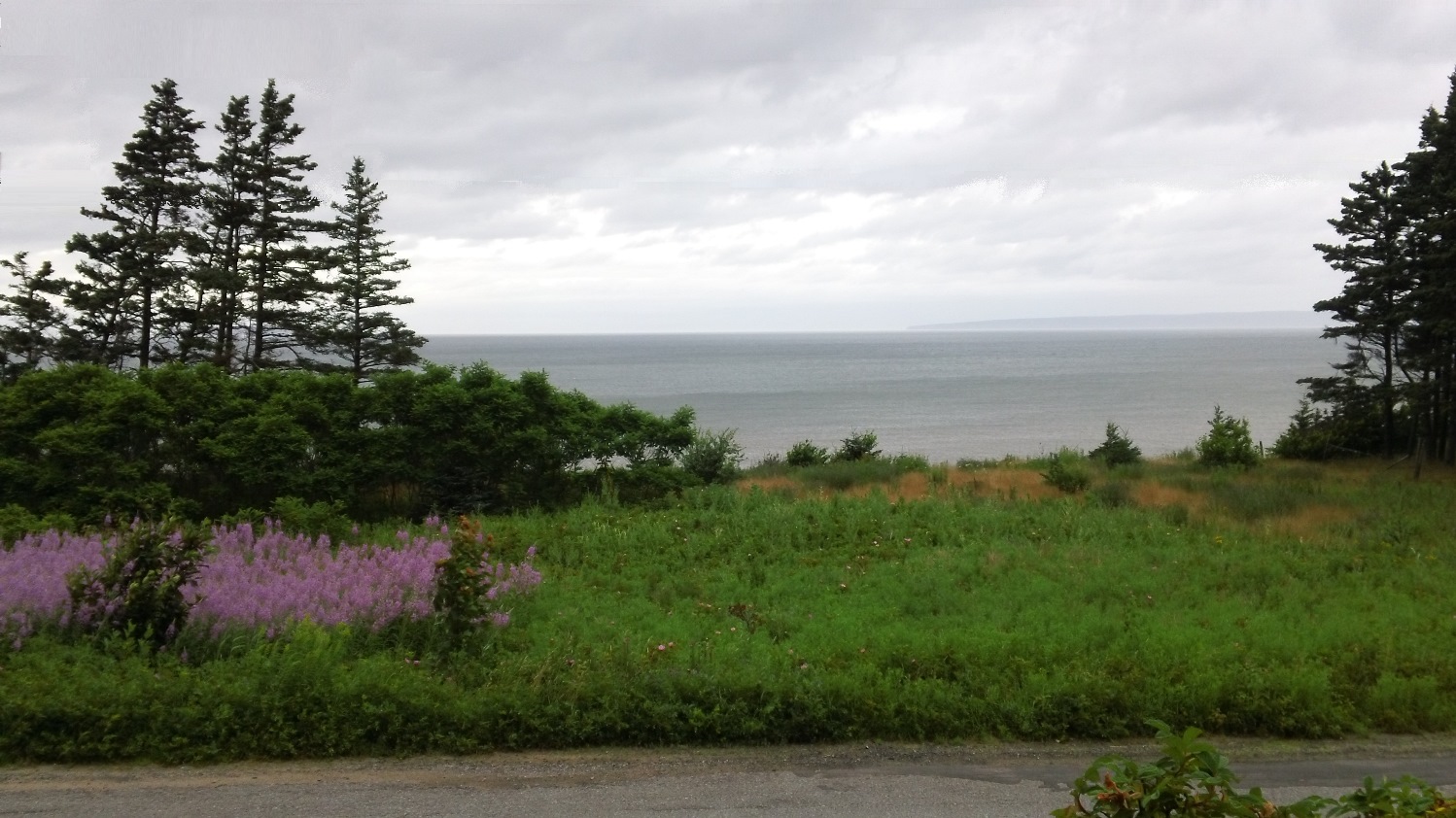
   The George Washington Bridge has always been a favorite starting point for my NYC cycling adventures, and I always enjoy the Hudson River view, even if it was a bit overcast.


   The air was cool but quite muggy, and I found myself in for a very sweaty day – glad I had two water bottles ready to go! This wasn’t going to be an epic ride, just over 40 miles or so, if I had time to ride down to Central Park for a lap, but I brought along a snack anyway.
   Last time I was in NYC, the upper trail that led to the pedestrian/cyclists crossing on the Henry Hudson Bridge was closed. Fortunately, the wickedly steep connection was open this time around, and my legs and lungs were quickly burning as I crossed Spuyten Duyvil Creek. The Dutch name means “spouting devil”, in reference to the tricky tidal currents in this area where the creek meets the Hudson River.

The swing bridge at Spuyten Duyvil used to carry freight trains heading down to NYC's High Line.

   NYC is very cycling-friendly these days, with more bike lanes being painted or becoming road-separated every time I visit. However, I found the condition of the Moshulu Parkway Trail to be among the worst I’ve ever encountered, with tree roots, holes and broken pavement galore. I don’t like it when people ride on sidewalks and would usually never do so, but the adjacent concrete was deserted at midday, so I decided to go that route much of the way.
   The trails improved greatly, I suppose somewhat understandably, as I neared the Botanical Gardens, but here is where I was misdirected. The route I had plotted on my cue sheet using Google Maps had me taking a trail along the Bronx-Pelham Parkway, and I mistakenly turned north along a road called Bronx Park – close, but...
   The trail condition deteriorated, and the bordering neighborhoods became unexpectedly shabby after a couple miles – I was expecting a lot more greenery towards Pelham Bay Park. When I started seeing signs for White Plains, I knew I had taken the wrong fork in the road. My little eight-mile detour would cancel my Central Park loop, but no big deal.
   Turns out the trail along the north side of Pelham Parkway wasn’t all that fantastic either, with mud pits and tree roots dominating the surface. When I eventually spied the beautiful greenway on the south side of the parkway, I hopped my bike over the curb and crossed the four lanes of traffic when there was a lull.
   This portion of Moshulu-Pelham Greenway rivaled any of the great bike lanes I rode in Europe, other than a couple awkward crossings over on/off ramps for I-95. Granted, this was Pelham Park, so it wasn’t crazy-busy, but it was still very strange and rather dangerous, with the speed the cars were travelling!

This Google Maps image shows the strange highway/trail configuration.

   As I crossed the bridge onto City Island, I caught a beautiful view out over Eastchester Bay. If you look closely, you can see the Manhattan skyline in the distance on the right, and among the yacht masts, you can spot the vertical supports of the Whitestone Bridge.


  On the island I immediately caught the distinct smell of seafood and turned left to take the photo below. It wasn't especially picturesque; I just liked the huge hand-painted sign next to its neon neighbor!


   I would describe the City Island community as if someone dropped Royersford at the shore – a small-town suburban feel with all the seafood joints and marinas included. The trees and plantings were more of an inland, deciduous variety, not the scrubby pine and bayberry that dominate the shore areas. I have heard that many families live on City Island, generation after generation in the same homes, and I can understand why, if someone grew up loving the big city but also appreciated a bit of isolation.

   On my return ride, I decided to veer south and follow the wonderful Hutchinson River Greenway down towards the Cross Bronx Expressway. I rode down 177th Street to meet up with my intended route on a nice bike lane along Tremont Avenue, which had a couple of steep, twisty climbs. I had good legs that day and had a lot of fun racing the traffic between lights.
   Making a left on University Avenue, I headed over to cross the Harlem River on the High Bridge, which has quickly become a favorite spot of mine, and then rode the trail that weaves up through Highbridge Park. I then took another painted bike lane on 170th Street across Washington Heights back to the GWB.


   Another reason I enjoy visiting NYC is because of all the historical railroad structures still in use, such as Grand Central Station and the High Line park. The restored Lackawanna Terminal in Hoboken still hosts NJT train service and NY Waterway ferries, and the Jersey Central Terminal in Jersey City, which last saw trains in 1967, now serves as a departure point for Liberty State Park cruises.
   On my way to Brooklyn from the George Washington Bridge, I drove down I-278, alongside the Hell Gate Bridge, which was built by the Pennsylvania Railroad in 1917 and is now part of Amtrak’s Northeast Corridor. At the time of its construction, it was the longest steel truss bridge in the world and was certainly the inspiration for designers of the Tyne Bridge in Newcastle, UK, and the Sydney Harbour Bridge.


   Certainly the 1,107-foot central span over the East River is impressive but so are the miles of concrete pier approaches on each end. To the east, trains soar high over Astoria Park and the neighborhoods of Queens, while on the west side they curve sharply north above the playgrounds and ballfields on Randalls and Wards Islands.
   I absolutely hate paying huge tolls and will spend more time on a local route if it means saving a handful of bucks. When planning my route home from Brooklyn, I dreaded the $17 toll to cross the Verrazano-Narrows Bridge. Since I would be heading back well after rush hour, I initially considered the Hugh L. Carey Tunnel back into Manhattan, which is only $8.50, and because the Holland Tunnel is free into New Jersey, that was a significant discount.
   Sue then mentioned that the Brooklyn and Manhattan Bridges are both free, and after noticing that the Manhattan Bridge links directly with Canal Street, which leads directly to the Holland Tunnel entrance, I was set. $8.50 instead of $17 sounded great, but FREE was excellent!
   After dropping off the Saronni and having a nice visit with Taylor and his family, I drove just a couple blocks to deliver the Peugeot to a craigslist customer. The drive home was wonderfully uneventful, and I enjoyed the view of the Brooklyn Bridge and city skyline all lit up as I crossed the Manhattan Bridge. The city was nicely cleared out by the time I reached downtown, and I zipped down Canal Street to reach the Holland Tunnel ramps.
   I was glad to find that, for once, there wasn’t a tremendous back-up coming out of the tunnel. The approach and exit on the New Jersey side have 4 straight blocks of traffic lights. How can backups not be expected? These intersections interrupt the flow of what is essentially a six-lane highway - I can’t imagine there is a situation like this anywhere else in the world!
   From there it was a quick shot to the Pulaski Skyway, one of my favorite routes away from NYC, with views of the railroad lift bridges over the Hackensack River, as well as the CSX intermodal yard in Kearny, NJ. Soon it was a simple connection to I-78, and I was pretty much home free.

Well, not free, but a lot less light-in-the-wallet than I might have been without some careful route planning!


Tuesday, August 14, 2018

Maritime Canada, Part 8 - Boats, Bikes and (too much) Van

   In hindsight, maybe so much physical activity in one day, just before starting the long drive home was a mistake, but it did set us up for a really good night’s sleep!
  
   The shaky weather situation the previous two days left us trying to do two activities that were still on our agenda, one of which was kayaking on the north shore. We headed a half-hour west to the town of North Rustico, where there was a very convenient area to drive onto the beach and unload the kayaks from the van.
   Strangely, the most difficult paddling was in the harbor, as we were fighting the incoming tide and crazy currents around the jetty and sandbar at the mouth of the inlet. Sue snapped a shot of me passing the lighthouse:


   Once out of the harbor, we found the Gulf of St. Lawrence to be incredibly calm, with occasional gentle swells or boat wake the only disturbances. The Northumbria Strait on PEI’s southern side, because it is shallow, is notorious for having the warmest summer waters north of Virginia, but the Gulf was amazingly comfortable as well!
   We picked one of the red cliffs that jutted out a couple of miles in the distance and headed for it, and with just a light breeze and no waves or current to fight, we reached it in a short amount of time. There wasn’t a whole lot to see out there, but we laughed at how easily we could hear over the water the shrieks from children way back on the beach.

   We were baking out in the sun because we were so close to the cliffs, which sheltered us from the small amount of wind that existed, so we moved out into the open water a bit farther, where we could see rippling from breezes. Laying back in the kayaks and lazily drifting around for a while has become a favorite pastime of ours on this trip!


   With the breeze at our backs, it took even less time to return to the harbor, which featured a crew of people taking turns diving off the jetty into the channel. We took a short break at the beach, then rowed up the harbor to take a photo of the neat little fishing shacks lining the waterfront.


   At this point Sue and I thought (more on this later) we had become quite adept at lashing the kayaks to the roof. She would climb up on top, and I would hoist the boats up to her. She would secure them to the vertical rack, then I would scramble around the sides, looping/tightening the straps around the roof rack. We would be careful to keep the straps as flat as possible against the hulls of the kayaks to prevent the annoying humming that can occur while driving at high speeds. If there were any spots where the straps were left out in the open, we found that putting a twist in the strap at that spot would usually eliminate any noise. There really had been no major issues since we set out from Royersford!

   After grabbing some snacks back at the cabin and changing our clothes, we set off on a bike ride, pretty much back in the direction we came from North Rustico, but we veered into the entrance of Prince Edward Island National Park. A wonderful traffic-separated bike lane took us along the six-mile length of the Gulf Shore Parkway.


   It happened to be one of Canada’s “long weekends”, kinda like Britain’s “bank holidays”, and we were completing our loop as many folks were heading home, so traffic was a bit heavy once we left the park. Again, Sue had planned to ditch partway, especially since we had also done the kayaking, so she turned back toward the cabin site, and I continued south to meet up with another part of the Confederation Trail.
   This eight-mile section of the trail ran right through the middle of the province and was quite remote compared to areas over which we had traveled previously. Most of the surface was grassy double track through dense evergreen forest, and there were only three minor road crossings along the way. There was a bit of a grade in the middle, but this was a railroad after all, so nothing too challenging.
   Our riding experiences on Prince Edward Island didn’t do anything but support the idea that the province is indeed a cycling paradise. Judging from the numbers of people we saw on the roads and trails, many folks agree!

   We knew that we were driving back into some heat in the U.S., so we started off rather more unenthusiastically from this vacation than we normally would. Our moods did not improve when we had to stop multiple times to adjust the kayak straps, as inside the van it sounded like a swarm of bees watching a cello concert!
   None of our stops to tweak the setup had worked, and the final time we pulled over to find both kayaks lying flat on the roof! The knob that keeps the rear vertical rack...uh...vertical had loosened (maybe from the extreme vibration?), and both boats collapsed down on top of the van. They must have slid gradually, otherwise we surely would have heard some type of thud.
   There was no alternative but to start from scratch, and we were lucky to find a breezy stop safely off the highway to restart our usual operation. It must have been quite a scene to those passing by with Sue up there on the roof. Thankfully, we nailed it this time around and had no further issues.
   Our midway Airbnb accommodations were in Yarmouth, Maine, a second-floor bedroom/bath in someone’s home. I find these situations somewhat strange, but the hostess was a sweet older lady, and the digs were very comfortable – and air-conditioned!

   The rest of the drive home the next day was rather uneventful, which is definitely good news, and as expected, we pulled into Royersford on a typical brutally warm/humid Pennsylvania summer evening. We grabbed the cooler and a few necessities but decided to leave the rest of the unpacking for the next day, when the temperature would be a little more bearable.
   I had received amusing news that my wife’s family had rescheduled their annual Seafood Fest at the Jersey shore – to the upcoming weekend. Apparently about 3000 miles of driving wasn’t quite enough, so we were going to be on the road again in just two days. At least the 2½-3 hours behind the wheel would seem rather brief after two straight days of 8-hour drives!

   Many packages had arrived during our vacation(s), and I was finally able to wrap up the Colnago Saronni single-speed bicycle project. I’ll sign off this final trip log with some images I snapped this afternoon, when we returned from the shore:


Sunday, August 12, 2018

Maritime Canada, Part 7 - A Few Days On PEI

   Our pre-planned strategy for the day’s bicycle journey was to do the out-and-back from
Mt. Stewart to St. Peters, about thirty-three miles, and then I would continue on myself, about another eleven, back to the cabin. Sue always says something about “holding me back” when we ride, and I have to reiterate how dialing down the pace makes the experience much more enjoyable for me. If I need/want to hammer it, I can always do more miles afterward, and later on in the day I'd have the perfect opportunity.
   After all, we were here to spend time together, see new sites and have a good time - we’re not doing any of those things when we’re flying by the beautiful scenery, burying ourselves in sweaty misery!

   Mt. Stewart is at the junction point of the east-west main artery of the Confederation Trail and the north-south leg that heads toward the capital city of Charlottetown. The trailhead in the middle of the wye includes a nice-sized parking lot, a pavilion for picnickers and a combination welcome center/library/bakery.
   Heading east, we were immediately in the middle of a lush forest with flowering bushes and a few beaver (didn’t see any) ponds. A katydid scared the living crap out of me as it buzzed by my head, clicking more loudly and at a faster tempo, as it nearly crashed into my helmet. I think he was either warning me or giving a “heads up” to a couple of his friends farther along the trail, as there were some more crazy clickers a short way up the path.
   The trail was perfect for ‘cross bikes like ours with a consistent surface of crushed gravel, mostly of the reddish stone to which we have become accustomed in Atlantic Canada. Some of the less-traveled sections looked like parallel single-track and had a softer feel with some of the greenery intruding on the gravel. Our knobby tires rolled smoothly over these sections, and with all the off-road riding we’d been doing, the conditions were very welcome on our butts and hands!


   Most intersections included street names for reference points and there were frequent kilometer signs to give riders additional progress markers. There were occasional spots of thick gravel near some of the road crossing gates, but because we were slowing down anyway, they didn’t create problems.
   At about nine miles was the town of Morell, marked by an old PEI Railway station that now houses an information center and bathrooms for the trail. Just across the street was a food trailer doing a good deal of lunchtime business selling fries, and we weren’t sure if it was a good or bad thing that we left our money back in the van.


   There was an incredible variety of scenery, from dense evergreen forest to wheat fields and even a commercial blueberry farm. Eventually we emerged from another forest onto the marshy lands along St. Peters Bay, upon which we could see neat rows of buoys marking the oyster and mussel beds that are part of the area’s aquaculture industry.


   When we reached the outskirts of St. Peters, we were a bit surprised by the tents, RVs and trailers parked around the trail area, as we had no idea the town’s blueberry festival was taking place that weekend. Most of the action was happening away from the path itself, so other than a few pedestrians occasionally crossing, it was no big deal.
   With only a population of a couple hundred people, the town itself didn’t have a lot to it, but there was a row of shops and food spots called St. Peters Landing and a nice little park, perhaps for passing cyclists to use as a picnic spot.


   The return leg wasn’t much more than the same thing in reverse, although the sun was very intense, and the temperature was a bit higher inland. We had been spoiled by a couple weeks in the cool air around the Bay of Fundy! Prince Edward Island was supposedly having a bit of a heat wave, even if “approaching 90 degrees” in the summer would usually seem a bit wimpy to us. I suppose when PEI’s normal temperature is 73 at this time of year, 90 does seem hot!
   Sue has always had a bit of a faulty thermostat, as far as regulating her own body heat, and she was feeling pretty “done” when we reached Mt. Stewart, so I think she was probably more willing for me to ditch her than normal. I have gotten in a good amount of riding this trip, but it has been a while since I’ve really been able to do a long, flat run like I get to do on our area rail trails. I was looking forward to this!
   The trail I rode back toward Corran Ban felt really remote in sections, though I knew the main highway was always just off to my right a couple hundred yards or so. I could see nothing but meadows and bog areas near the river off to my left, and a dense line of forest screened off my right side. I laughed to myself when, a few miles into the ride, I reached a clearing at a road crossing and could see a familiar van with red and green kayaks atop, going off in the distance.
   Strangely, when I finally made the intersection with Route 6, which headed north toward our cabin site, I almost felt like someone had dropped me back in Pennsylvania. Other than the presence of an occasional potato field that would have tipped me off to my true location, the hot, humid air, along with the rolling road through cornfields, and a countryside dotted with farmhouses, barns, silos and cow pastures, made me feel right at home!

   The next couple days featured iffy weather, as some rain and thunderstorms were lurking in the area. We lucked out a bit on Saturday, though it was rather hot and humid in the morning, and we were able to get in a walk through Charlottetown, including a visit to St. Dunstan’s Basilica and lunch at a floating fry shack at the marina.


   A cool front came through in the late afternoon while we were killing a couple hours in the library, which made for a pleasant stroll on Victoria Row. The pedestrian-only street is lined with Victorian-era storefronts, now filled with restaurants and boutique shops – a great place to sit and people-watch.
   The wind picked up a bit and some threatening clouds moved in, but we were able to enjoy a delicious dinner at a gluten-free fish and chips place called Brits. The absolutely necessary follow-up was a stop for some soft-serve ice cream – it coats and soothes after the fried batter foods!


   Rain and mist was off and on the following day, so we set out on a drive down the eastern shore. Sue is a bit of a beachcomber, with her main preference being sea glass. Souris (which means “mouse” in French, and is pronounced sore-ee) lighthouse (photo above), which was the last manned light on PEI in 1991, stunned Sue with an immense display of sea glass in all different colors. She commented on the interesting pieces of sea pottery and regretted that she didn’t have any in her own collection.

   While at our cabin, Sue had done a little bit of investigating into some of the good locations for “treasure”, and we checked out four or five spots. Ironically, at a location called Poverty Beach, Sue came up with her first piece of sea pottery.

I just hope, in a couple days, the border police will let her back in the country with her “loot”!


Friday, August 10, 2018

Maritime Canada, Part 6 - Harbourville, Nova Scotia, to Corran Ban, Prince Edward Island

Sunset with Isle Haute, taken by Sue
   I wanted to get in one more ride before we left the Bay of Fundy area, and since I felt a bit let down by my failed attempt to get over the big ridge (which I learned is called North Mountain) from the Annapolis Valley side, I challenged myself to try again. This time I chose to take Long Point Road, which had a more consistent grade than Route 360, as Sue and I had noticed when returning from our ice cream reward a couple of days earlier.
   I also wanted to explore a bit more of the area to the south of Harbourville, so I started off that direction, heading out some unpaved roads toward Victoria Harbour. The route had plenty of rolling hills to take the steam out of a rider’s legs, and I was sure to pace myself with the long climb up the bayside of the ridge still on the menu, let alone the “big hill”.
   The road out of Victoria Harbour was nicely paved, considering how many of the area surfaces are weather-beaten, and a consistent wind was at my back to help lessen the effort a bit. Over the top of the ridge the road followed a much straighter path than any of the other parallel routes leading down into the valley, and I was able to coast down at a pretty high speed without having to brake too much. I am a bit more cautious than I would have been, say, twenty years ago, but with smooth paving and good sightlines, it is still great fun to just tuck and go!
   Not many streets in, out or through the Annapolis Valley are very flat. After I made the left-hand turn on Route 221, I faced a constant series of small hills up and down, crossing small bridges over streams that irrigate the fertile valley which supports a diverse agricultural industry including fruit trees, berries, livestock and wineries.
   Long Point Road greeted me with a steep start, but nothing like that of Route 360, as I was able to keep my breathing under control and also my legs from completely blowing up. I don’t usually like to climb out of the saddle, since I tend to accelerate and lose a consistent cadence, but a couple of times I stood up just to change position and concentrated on keeping smooth.
   There certainly isn’t anything like North Mountain to practice on around Royersford, so while putting out this type of 10-15-minute effort, I was thinking of it more as a time trial, just holding the tempo as long as possible. I knew the rest of the ride was pretty much downhill, so I really didn’t have to save anything for the run back to the house.
   I was really surprised at how good I felt near the top and decided to cut across the ridge on Brow of the Mountain Road, just to add some miles to the ride and work some of the fatigue out of my legs. I took a photo of the wonderful view down to the Annapolis Valley.

   My intent was to again spare myself the nasty climb out of Harbourville’s marina, so I cut across Barley Street back to Long Point Road and enjoyed racing down that long gradual slope back to the house. 

   It was sad to leave the Bay of Fundy area the next morning after such a peaceful stay, and although I like to have access to information and contact with the outside world through the internet, I can’t say I missed it totally. Taking a “tech break” was kinda nice, and think I appreciated the ‘net hiatus even more when I had to catch up on emails later!
   Our final stop on this travel day was to be Prince Edward Island, but we had a few interesting places to visit along the way, including Burncoat Head Park, which has the world’s most extreme range of tides at 53.6 feet! We arrived at low tide so that we could walk out on the Minas Basin floor – it was amazing to think that in a few hours, if we were still standing in the same spot, we would essentially be under over forty feet of water.


   The next destination was South Maitland, where a tidal bore, which is a large wave caused by a flood tide funneling into a long, narrow and shallow inlet, forms on the Shubenacadie River. Unfortunately, other than spotting a few bald eagles, the experience really ended up more of a BORE, as the river was running rather dry, and a strong outflow would have made the scene much more dramatic with a larger wave. It still was pretty interesting to see the slow, northerly-flowing river that was meandering through sandbars toward the basin, turn in a matter of minutes into a churning, southerly flowing river.


   We felt bad for the folks who had paid for the “whitewater” (brown, really) rafting experience, as the guides had to make their own fun zigzagging in and out of the rapids of rather measly size. The passengers didn’t seem overly disappointed as they whooped it up when flying past us.


   Early in the evening we reached the Confederation Bridge, which is an eight-mile structure linking the province of Prince Edward Island with mainland New Brunswick, Canada. At the visitor center we watched a fascinating feature on the construction of the multi-span balanced cantilever bridge, as the often-frozen water of Northumbrian Strait had to be considered during its design. I’ll leave you to investigate, if you are interested.


   We were staying in a modern, pre-fab wooden cabin in Corran Ban, not far from Tracadie Bay on the island’s north side. The first settlers in Corran Ban were from Moidart, Scotland. When the fresh water of Winter Bay meets the salt water of Tracadie, it forms white foam, shaped like a sickle. Corran Ban is Gaelic for “white sickle”.

    Prince Edward Island has a reputation as a cycling paradise, mainly on the strength of the 292-mile Confederation Trail system, which has two main branches stretching almost the whole west to east length and north to south width of the island. The province has worked to build spurs to connect most of PEI’s larger communities to the main branches and has additional routes planned or under construction.
   The trail system is built mostly upon the roadbed of the former Prince Edward Island Railway, which was operated later by the Canadian National Railway. The railroad saw boom times during WWII, but with the competition of trucks, saw a sharp decline. Canadian National had removed most trackage during the early 1990s, and completion of the Confederation Bridge in 1997 eliminated any need to float freight cars over to the island on barges. The abandoned railroad lines were sold to the provincial government for development.
   The trail and bridge are named in honor of the 1864 conference in Charlottetown, PEI, to discuss the British Confederation of Canada (at the time, consisting of Quebec and Ontario) with Nova Scotia and New Brunswick. Ironically, Prince Edward Island’s main reason for joining the Confederation three years later was bankruptcy, mostly brought upon by the costs of building the railroad!

   Tomorrow afternoon, Sue and I will take a ride east on the trail from the town of Mt. Stewart toward St. Peters Bay.


Monday, August 6, 2018

Maritime Canada, Part 5 - A Week On the Bay of Fundy

   My wife has said that, on rough days during the school year, this was the segment of the trip she had most been looking forward to. She often thought of being at this pretty little house with not a whole lot to do, sitting on the porch overlooking the Bay of Fundy, maybe just reading a book and/or listening to some soft music.
   Everything has gone according to plan except for one thing – it’s day #4 here, and we haven’t been able to see across the bay since the afternoon we arrived. It seems all of Nova Scotia has been stuck in this rut of warm, moist air moving up from the southeast over the cool water – a perfect recipe for fog! We’ve had some days of beautiful, sunny weather up here on the ridge above the bay, but down below it is just a gray sheet as far as the eye CAN’T see!
   We had some hope this morning when we could see a couple buoys way out in the water, and we were sitting out on the porch watching some hummingbirds buzz in and out of this patch of purple flowers in the field across the street. Alas, in a about 30 minutes the buoys were completely enveloped in low clouds.
   A few friendly neighbors walked by to say hello and ask, after seeing our PA license plate, exactly where we were from. I think they felt it was their responsibility to tell us the weather pattern was unusual, and that eventually the bay would be in regular view!
  
   We drove into the town of Wolfville, where we were disappointed to find out the town had not been once overrun by wolves but had been named after someone with the last name “Wolf” - darn it! The weather there in the valley was clear of course, and we did catch sight of the Minas Basin, which empties into the Bay of Fundy.
   The Minus Basin land was once called Acadia by French settlers in the early 17th century, and the people became known as Acadians. France and England were constantly at war during this period, and tensions became especially high when the Treaty of Utrecht established British Nova Scotia. Acadians would not take an oath of loyalty demanded by lieutenant governor Charles Lawrence, and the deportation/expulsion began.
   About 14,000 Acadians were forced out of the area – villages were burned, and people were boarded onto boats. Many of the people headed to Louisiana, where their name was Anglicized to “Cajun”. There were a number of people who chose to hide in Nova Scotia, and in later years many of the deported people returned. Today, most of the French people in Canada’s Atlantic provinces are descendants of the expelled Acadians.
   Dikes that were constructed in the port of Wolfville by Acadians during the early 1600s still mark the landscape. Walking trails that run along the tops of the dikes feature many informative signs which explain the history of the region and show the changes to the local geography brought about by erosion during the extreme tides.
   One sign displayed the topography around Cape Split, which lies at a point north of Wolfville where the Minas Channel narrows to meet Minas Basin. I learned that during the periods of maximum flow, about a cubic mile of water per hour is moving past the cape. That is more water than all of the fresh water rivers and streams in the world combined!
   Since Wolfville was home to Acadia University, we assumed there would be a laundromat or two in the vicinity, so we took the opportunity to do some wash. We also stopped at the library, which is housed in a former Dominion Atlantic Railway station, to catch up on email and highlights of the last couple days of the Tour de France.

   I hate Team Sky and the way their scientific method of cycling has ruined competitive racing, but I have always had a warm spot in my heart for Welshman Geraint Thomas. During interviews and cycling features I’ve seen, he always seemed to be a great guy, and I’m glad he has had a chance to shine after years of quietly taking a back seat to other teammates. I absolutely loved visiting Thomas’ home country a few years ago, and I hope his Tour victory brings a lot of pride and excitement to the people of Wales! Now if he would only switch teams (fat chance).


   Wouldn’t you know it, after a restless night of sleep during some cracking thunderstorms that seemed to echo endlessly across the Minas Channel, we have had a couple days that you could see completely clearly across the 30-mile distance to New Brunswick! The Isle Haute and Cape Chignecto could easily be spotted from the porch of our house, and when we walked on the beach, we could see Cape d’Or and even spy Cape Split far up the channel.
   Sue led me down the rocky shoreline to see some interesting formations she witnessed during a low-tide hike she took the other day. It was incredible to think most of these areas were far below the water when the Bay of Fundy tide was at its highest level.


   On Monday we took a bike ride out to Halls Harbour, and I thought I had planned our route fairly well to limit the number of leg-breaking hills along the way. Man was I wrong! I think that when I was looking at the comparative climbs of 600-700 feet, the 80- or 90-foot climbs didn’t look so bad. The problem was the short distance in which you were covering those heights. Some of the unpaved roads were impossible to ride up, especially after the recent rain deposited sand and dirt within the rocks and gravel that was already quite thick.
   There were a couple sections where we decided to walk, because our front wheels were sinking while the back wheels were spinning out on the loose debris. Sue took a picture down one particular slope that was just ridiculous, but it didn’t really do the terrain justice – you simply had to be there to get the complete perspective.
   Another problem was that not all the roads were marked by street signs. Some intersections had directions to towns along the way, but we weren’t looking to ride all the way down to the waterline, and most of the towns aren’t connected by streets that run along the shore anyway. I talked to a few locals along our route to confirm we were headed the correct way, and they often tried to point me towards something scenic, but our enthusiasm was dwindling.
   We were happy to reach Halls Harbour but discouraged by yet another nasty hill that we had to “look forward to” on the way out. The town has that wonderful picturesque fishing village look, and we were there to witness some of the local watermen loading up their boat with lobster pots and other gear then head out of the marina.


   There was a substantial stone jetty protecting the marina, with a large seafood restaurant and a cluster of pretty homes facing the Minas Channel. With such clear weather (finally), we could easily see across to Spencer Island, which from our house would be obscured by Cape d’Or, and we could even spy the broken cliff that gives Cape Split its name. 
   The return ride provided some more adventure, as there was no way we were going to head back the same route on which we reached Halls Harbour! We decided to ride all the way up the ridge above the channel and attempt to find a crossing road on the plateau. Little did we know that there were no connections up on that part of the ridge, and we ended up riding down the other side into the valley on another steep, rocky and partially washed-out road. It felt like we had a vice grip on the brakes all the way down, more sliding than coasting.
   When we finally linked up with the familiar Route 221, which runs parallel to the ridge to meet Route 360 to Harbourville, I began planning ahead in my mind. I figured on leaving Sue to rest at the base of the ridge and riding back by myself to get the “rescue van”. I didn’t really like the idea of climbing over the ridge, but I had a decent amount in reserve while riding at Sue’s pace. Not to demean her in any way, because she toughed-out this gnarly ride really well, but she simply doesn’t put in the miles that I do, which involve continuous climbing/recovery along the way. She was fairly wasted, and those dirt/stone roads kick the crap out of anyone after a while!
   Again, some roads look so much easier in a car. On the bike, Route 360 looked and felt like the Mur de Huy - this road climbs 500 feet in under a mile and a half! I got around the impossibly steep switchback about halfway up (photo below), then just ran out of gears. My legs felt like they might have been able do it, but not with the more limited range of the 1x10 setup on my ‘cross bike. It’s really discouraging to have to walk up a paved road.


   The back side of the ridge made up for any disappointment. I had decided to cut across Brow Mountain Road to approach our house from the west, in order to avoid the brutal climb out of Harbourville’s marina and was left with a 3 ½-mile run home, almost completely downhill! A gusty wind had kicked up during the afternoon, forming whitecaps out on the distant bay, and I probably would have liked it to be a bit calmer for safety-sake during my descent. However, the coolness in the air coming off the bay felt fantastic, after the effort I had put out on my way up the ridge.
   I really appreciated that the road had a good asphalt surface and that it was fairly straight. There is nothing like putting it in the biggest gear and letting ‘er rip! I had to slow down considerably on the very steep drop and curve near the beach access point, particularly because of the debris that the rain had washed into the turn, but I still had a good amount of speed going so that a brief out-of-the-saddle sprint was the only thing needed for the short climb up to our house.
   Sue had managed to ride out to meet me at the base of that nasty switchback, and I was shaking my head at her for going farther than I expected, while she was shaking her head at the prospect of me even getting up part of that hill. We decided a drive into nearby Aylesford for some ice cream was definitely in order.


Saturday, August 4, 2018

Maritime Canada, Part 4 - LaHave to Harbourville, Nova Scotia

   The last full day we spent on Bush Island, Sue had intended to make blueberry pancakes for breakfast, taking advantage of all the wild blueberry bushes that were growing around our cabin. The previous evening, she had wandered out into the yard while I was writing and picked only about a handful before the bugs started driving her crazy. Disappointed by her “crop”, she turned instead to a large carton of strawberries we had purchased on our way out of Halifax. I don’t remember ever having strawberry pancakes before, and they were pretty fantastic!
   All carbed-up and ready to roll, we hoisted the kayaks down from the Odyssey roof and set off on a 5-mile kayak tour of the LaHave Islands. We had initially been concerned about mosquitos and other biting insects and had brought repellent just in case, but the constant breeze and our relative distance to the land eliminated that threat completely – YES!


   The warm, moist air was still in place and we could see the effects all around the area, but as has also been the case all during our stay, the relatively warmer waters behind the islands kept things clear in our immediate area. Sue kiddingly pointed out to the FAR east and said, “Let’s go out around Moshers Island”. The end of the large island could barely be seen on the horizon, if it wasn’t in fact disappearing into the fog, and breakers could also be seen along the way. Our open-cockpit kayaks were definitely not made for breaking waves.
   There were some decent swells coming into the channel called False LeHave, and we had some fun riding those later, but we decided to keep things safe and head northeast around Hirtle and Coveys Islands. These two rocky pieces of land contained a few homes, and because they can only be reached by boat, we imagined the peaceful life that could be had out there, if you could get over the obvious inconveniences. We did notice poles and lines, so they must at least have electricity.
   While we crossed the large (about a half mile) stretch of open water, Sue reminded me of the whale and orca sightings around Nova Scotia. She knows I am not the most comfortable person in water, and I assume she was just trying to freak me out a bit, considering our small boats and the prospect of contact with one of those large mammals. She also knows seeing orcas is one of my life-long dreams, but definitely not while I’m in a kayak!
   The back side of the islands were quite sheltered from the wind and currents, and the inlet was very shallow. Although the route was also fairly rocky, it was easily navigable with small craft like ours. The water was crystal clear, and you could easily see the three or four feet to the bottom. We were a little disappointed not to see any fish. Maybe the constant presence of the diving cormorants has taught the fish to stay safely in deeper waters.
   As we rounded Covey Island we could almost make out the small Bush island beach from which we had launched about an hour ago. We could also sight the line of utility poles that run along the road on the north side of Crescent Beach, which connects the islands to the mainland. It was discouraging not to be able to visit the beach and experience the unique view - the fog had eliminated that prospect. We certainly weren't going to swim at the beach, since the chilly water temperature was really not to our liking.
   When we moved out further from the shelter of the island, we found the wind was gusting out of the south, almost unimpeded across Green Bay to the Atlantic. Crescent Beach was of course taking all of the breaking waves, but there were still whitecaps on the open water behind the thin spit of land.
   Although the waves weren’t tall enough to crash over our kayaks, they were splashing considerably on the hulls as we dipped down between each crest. I was getting fairly soaked, but Sue wasn’t – we theorized that her lighter weight had the kayak riding higher over the waves. The air was warm enough, and we were doing enough work that the cool water wasn’t a bother at all.
   We made our way out towards some small, treeless islands that seemed to be breaking up the waves and might make the return paddling easier. Sue commented how one large, lumpy rock almost looked like a walrus was sitting there. Just a few minutes later we both spotted something silvery bobbing about 50 yards off my bow. “It looks like a bird, but it’s too shiny,” I said.
   Just then (what turned out to be) the head rotated, and two big eyes and a whiskered seal face looked back at me. BLOOP – he ducked down out of sight! Sue was behind me a little distance and unfortunately didn’t get as much of an I.D. as I did. I then remembered her earlier remark about orcas and, knowing their favorite food, started to get a bit uneasy, but then I thought about how shallow the inlet was and how unlikely maneuvering back here would be for something so large.
   We made it back to the launch area after some hard paddling and took a brief rest before exploring the marina area protected by Bush, Jenkins and Bell Islands. There wasn’t a whole lot to see there except a few shabby shacks and a pile of lobster pots, but it was fun speculating exactly how many more car crossings the high, rickety bridge between Bush and Jenkins would tolerate before crashing into the water.


   The swells and light wind heading through False LeHave pushed us quickly back to finish the kayak tour at our end of Bush Island, but the air temperature and light breeze were just about perfectly balanced, so we chose to lay back in our boats for a while and just drift in the calmer water around the small rock islands near the beach landing.


   Our next day was mainly for travel, and we stopped in the town of Digby, which sits on the western shore of the Annapolis Basin, where its namesake river empties into the Bay of Fundy. Yes, the Annapolis name caught the attention of two University of Maryland grads, but because Digby is the largest municipality in the area, we knew it had a library where we could take advantage of their free internet access.
   After catching up on email and the Tour de France stages I had missed (Yay, Chris Froome fell apart!), we drove to Harbourville, which is on the south shore of the Minas Channel, right where it opens into the Bay of Fundy. Below are photos of the neat little house in which we stayed and the wonderful view out from our porch:


   The north shore of Nova Scotia reminds me a lot of the Finger Lakes region with the roads dropping off steeply from a ridge above the shoreline. Much like the area between the lakes there is a plateau once you get over the steep climb up from the basin. However, unlike New York, there isn’t a lake on the other side of the ridge, but a sharp descent into the Annapolis Valley.
   The morning after we arrived I was considering a ride and where I could go if I set out right from our little house. I considered continuing out our street to see where it might end up, but I wasn’t sure that would get me very far. We had noticed from some maps that not all the small towns along the water are interconnected by road. Many streets come down the hill and dead-end or just branch off a bit for some housing.
   Our house, a bit less than a mile from the center of Harbourville, was on a street that was a good height up from the bay, and I didn’t really want to drop into town at the marina and have to “start from scratch” and climb all the way up the 700-foot ridge from water level! We also noted on our way in yesterday that there weren’t many cross streets up on the plateau, so it seemed options might be limited once I climbed up there.
   We noticed a decent amount of traffic going by our place, and it had to go somewhere, so I took a chance. I was discouraged by yet another cool, foggy morning, but hoped it would be better at the higher elevation. I was also disappointed to find that, just a short distance into my ride, the road dropped down for a public access point to the bay, so it seemed I would be “starting from scratch” after all.
   The first hill didn’t seem worse than those I face any day I’m riding out of the Schuylkill Valley, and it came just as early as in those rides, too – no time to get in a groove! The only difference was that when the climb lessened in pitch, it still continued for a couple miles. Sun and blue sky started to appear, and the temperature became significantly warmer without the sea-breeze – in fact, there was very little wind up on the plateau at all.
   I passed a sign for Barley Street, and I remembered passing an intersection with that unpaved road on our way in on Route 360, because my wife became excited while misreading the road sign (her maiden name is Darley) when we had passed it. I noted that crossroad option back to Harbourville but continued on the paved street, as I could see it heading away for a good, level distance. I was looking to put in as many miles as I could, so turning around wasn’t a major consequence in my mind.
   A couple miles later it was obvious the road was starting its decent into the Annapolis Valley, so I turned back at an intersection with Brow Mountain Road. That route also looked promising as a crossroad, but I didn’t remember the name and didn’t want to end up down the hill in another direction.
   Returning to Barley Street, I found the surface to be perfect for my ‘cross bike – in fact, it reminded me a lot of riding on the Perkiomen Trail, with a solidly paved cinder surface that was well-worn. There were many patches of bare, hard-packed dirt that were wonderful to ride on. The only unpleasant stretch was on a short decent, where traffic had caused the cinders to migrate down to the bottom of the hill, leaving thick, rutted deposits. I was travelling at a good speed, and I had to be careful feathering the brakes, so the wheels wouldn’t lock up and slide in the stones. I picked a line, kept the front wheel straight and hoped for the best!
   This was definitely one case where the uphill felt better, as a burst of adrenaline had me practically sprinting up to the intersection with Route 360. I made a right turn to ride out to see that Brow Mountain Road did indeed cross the highway, then I doubled back. A couple miles down the gentle decent towards the bay, I found a road called Baseline that looked promising, though it was leading northeast, away from Harbourville. Again, just looking to add some miles to the route, it seemed like another good gravel/dirt surface worth checking out.
    About a mile along the way, I encountered a man taking a walk with a few children in tow (there were a few farms and residences here) and asked how far the road went. The man answered, “On Baseline? About a kilometer or so.” I thanked him then laughed to myself, first because I don’t know what road I would have been asking about otherwise, and second because he used kilometers, and I’m just not used to hearing that.
   Maybe he really wasn’t sure about kilometers, because the road rolled on for at least a mile, until it intersected with West Black Rock Road, which also struck me as amusing, since there is a road of the same name near our home. At this point I felt that I had done a decent number of miles and knew I still had a pretty tough climb in store before reaching our place back in Harbourville, so I simply turned around.
   I was hoping to see the family still walking on the way back, so I might strike up a little conversation, but they were gone. I reached Route 360 and enjoyed the long coast downhill, feeling the temperature drop considerably as I neared the bay, especially since I was rather soaked with sweat.
   The road steeply wound down into town center and crossed a bridge over a small creek that ran into the marina area. It was a strange contrast to our arrival yesterday, as the boats, which were previously sitting on their hulls in the muddy sand at low tide, were now sitting in 15-20 feet of water! I didn’t have a lot of time to sight-see, as I wanted to keep my momentum going for the immediate uphill climb to our little house.
   It didn’t last long, as it felt like someone pulled a parachute! Hills never look as bad when going up in a car, and although I remember driving on this road, it didn’t seem this brutally steep. I was quickly sliding all the way down the cassette, praying the chain wouldn’t slip, because there was no way I was going to be able to get my feet out of the pedals if I had to come to a stop! Luckily, I had enough in reserve to power through, and I was drawing inspiration from thoughts of pedaling last summer on the Muur de Geraardsbergen.