All carbed-up
and ready to roll, we hoisted the kayaks down from the Odyssey roof and set off
on a 5-mile kayak tour of the LaHave Islands. We had initially been concerned
about mosquitos and other biting insects and had brought repellent just in case, but the
constant breeze and our relative distance to the land eliminated that threat
completely – YES!

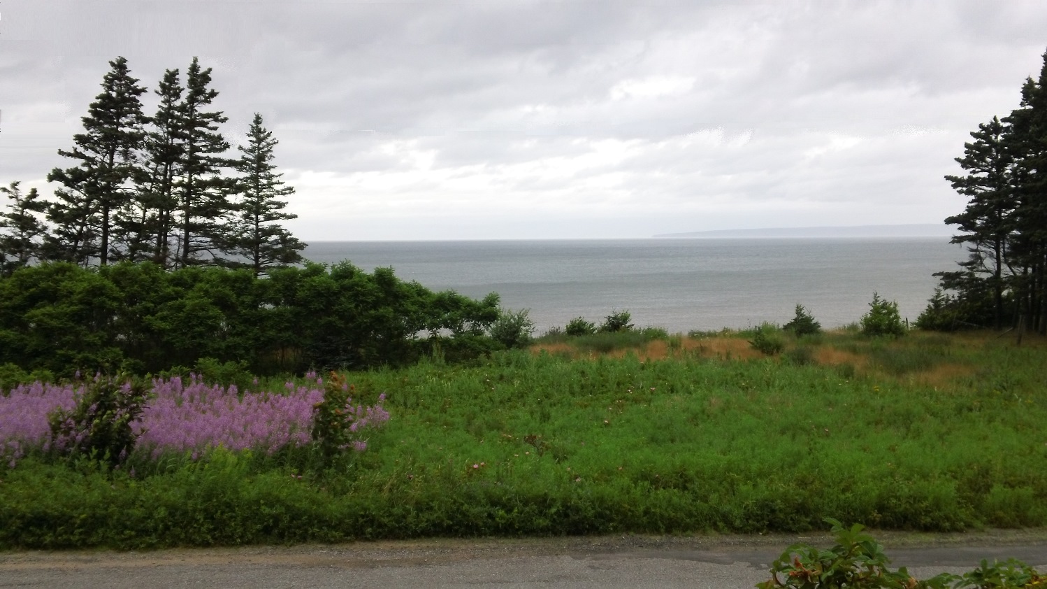
The warm,
moist air was still in place and we could see the effects all around the area,
but as has also been the case all during our stay, the relatively warmer waters
behind the islands kept things clear in our immediate area. Sue kiddingly
pointed out to the FAR east and said, “Let’s go out around Moshers Island”. The
end of the large island could barely be seen on the horizon, if it wasn’t in
fact disappearing into the fog, and breakers could also be seen along the way.
Our open-cockpit kayaks were definitely not made for breaking waves.
There were
some decent swells coming into the channel called False LeHave, and we had some
fun riding those later, but we decided to keep things safe and head northeast around Hirtle
and Coveys Islands. These two rocky pieces of land contained a few homes, and
because they can only be reached by boat, we imagined the peaceful life that
could be had out there, if you could get over the obvious inconveniences. We
did notice poles and lines, so they must at least have had electricity.
While we
crossed the large (about a half mile) stretch of open water, Sue reminded me of
the whale and orca sightings around Nova Scotia. She knows I am not the most
comfortable person in water, and I assume she was just trying to freak me out a
bit, considering our small boats and the prospect of contact with one of those
large mammals. She also knows seeing orcas is one of my life-long dreams, but
definitely not while I’m in a kayak!
The back side
of the islands were quite sheltered from the wind and currents, and the inlet
was very shallow. Although the route was also fairly rocky, it was easily navigable
with small craft like ours. The water was crystal clear, and you could easily
see the three or four feet to the bottom. We were a little disappointed not to
see any fish. Maybe the constant presence of the diving cormorants had taught
the fish to stay safely in deeper waters.
As we rounded
Covey Island we could almost make out the small Bush island beach from which we
had launched about an hour ago. We could also sight the line of utility poles
that run along the road on the north side of Crescent Beach, which connects the
islands to the mainland. It was discouraging not to be able to visit the beach and experience the unique view - the fog had eliminated that prospect.
We certainly weren't going to swim at the beach, since the chilly water temperature was really not to our liking.
When we moved
out further from the shelter of the island, we found the wind was gusting out
of the south, almost unimpeded across Green Bay to the Atlantic. Crescent Beach
was of course taking all of the breaking waves, but there were still whitecaps
on the open water behind the thin spit of land.
Although the
waves weren’t tall enough to crash over our
kayaks, they were splashing considerably on the hulls as we dipped down between
each crest. I was getting fairly soaked, but Sue wasn’t – we theorized that her
lighter weight had the kayak riding higher over the waves. The air was warm
enough, and we were doing enough work that the cool water wasn’t a bother at
all.
We made our way
out towards some small, treeless islands that seemed to be breaking up the
waves and might make the return paddling easier. Sue commented how one large,
lumpy rock almost looked like a walrus was sitting there. Just a few minutes
later we both spotted something silvery bobbing about 50 yards off my bow. “It
looks like a bird, but it’s too shiny,” I said.
Just then (what
turned out to be) the head rotated, and two big eyes and a whiskered seal face
looked back at me. BLOOP – he ducked down out of sight! Sue was behind me a
little distance and unfortunately didn’t get as much of an I.D. as I did. I
then remembered her earlier remark about orcas and, knowing their favorite
food, started to get a bit uneasy, but then I thought about how shallow the
inlet was and how unlikely maneuvering back here would be for something so
large.
We made it
back to the launch area after some hard paddling and took a brief rest before exploring
the marina area protected by Bush, Jenkins and Bell Islands. There wasn’t a
whole lot to see there except a few shabby shacks and a pile of lobster pots,
but it was fun speculating exactly how many more car crossings the high,
rickety bridge between Bush and Jenkins would tolerate before crashing into the
water.

The swells
and light wind heading through False LeHave pushed us quickly back to finish
the kayak tour at our end of Bush Island, but the air temperature and light
breeze were just about perfectly balanced, so we chose to lay back in our boats
for a while and just drift in the calmer water around the small rock islands
near the beach landing.

Our next day
was mainly for travel, and we stopped in the town of Digby, which sits on the
western shore of the Annapolis Basin, where its namesake river empties into the
Bay of Fundy - and yes, the Annapolis name
caught the attention of two University of Maryland grads! Because Digby is
the largest municipality in the area, we knew it had a library where we could
take advantage of their free internet access.
After catching up on email and the
Tour de France stages I had missed (Yay, Chris Froome fell apart!), we drove to
Harbourville, which is on the south shore of the Minas Channel, right where it
opens into the Bay of Fundy. Below are photos of the neat little house in which we stayed and the wonderful view out from our porch:

The north
shore of Nova Scotia reminds me a lot of the Finger Lakes region with the roads
dropping off steeply from a ridge above the shoreline. Much like the area
between the lakes there is a plateau once you get over the steep climb up from
the basin. However, unlike New York, there isn’t a lake on the other side of the ridge, but a sharp descent into the
Annapolis Valley.
The morning
after we arrived I was considering a ride and where I could go if I set out
right from our little house. I considered continuing out our street to see
where it might end up, but I wasn’t sure that would get me very far. We had
noticed from some maps that not all the small towns along the water are
interconnected by road. Many streets come down the hill and dead-end or just branch
off a bit for some housing.
Our house, a
bit less than a mile from the center of Harbourville, was on a street that was
a good height up from the bay, and I didn’t really want to drop into town at
the marina and have to “start from scratch” and climb all the way up the 700-foot
ridge from water level! We also noted on our way in yesterday that there
weren’t many cross streets up on the plateau, so it seemed options might be
limited once I climbed up there.
We noticed a decent amount of traffic going by our place, and it had to go
somewhere, so I took a chance. I was discouraged by yet another cool, foggy
morning but hoped it would be better at the higher elevation. I was also
disappointed to find that, just a short distance into my ride, the road dropped
down for a public access point to the bay, so it seemed I would be “starting
from scratch” after all.
The first
hill didn’t seem worse than those I face any day I’m riding out of the
Schuylkill Valley, and it came just as early as in those rides, too – no time
to get in a groove! The only difference was that when the climb lessened in
pitch, it still continued for a couple miles. Sun and blue sky started to
appear, and the temperature became significantly warmer without the sea-breeze
– in fact, there was very little wind up on the plateau at all.
I passed a
sign for Barley Street, and I remembered passing an intersection with that
unpaved road on our way in on Route 360, because my wife became excited while
misreading the road sign (her maiden name is Darley) when we had passed it. I
noted that crossroad option back to
Harbourville but continued on the paved street, as I could see it heading away
for a good, level distance. I was looking to put in as many miles as I could,
so turning around wasn’t a major consequence in my mind.
A couple
miles later it was obvious the road was starting its decent into the Annapolis
Valley, so I turned back at an intersection with Brow Mountain Road. That route
also looked promising as a crossroad, but I didn’t remember the name and
didn’t want to end up down the hill in another direction.
Returning to
Barley Street, I found the surface to be perfect for my ‘cross bike – in fact,
it reminded me a lot of riding on the Perkiomen Trail, with a solidly paved
cinder surface that was well-worn. There were many patches of bare, hard-packed
dirt that were wonderful to ride on. The only unpleasant stretch was on a short
decent, where traffic had caused the cinders to migrate down to the bottom of
the hill, leaving thick, rutted deposits. I was travelling at a good speed, and
I had to be careful feathering the brakes, so the wheels wouldn’t lock up and
slide in the stones. I picked a line, kept the front wheel straight and hoped
for the best!
This was
definitely one case where the uphill felt better, as a burst of adrenaline had
me practically sprinting up to the intersection with Route 360. I made a right
turn to ride out to see that Brow Mountain Road did indeed cross the highway,
then I doubled back. A couple miles down the gentle decent towards the bay, I
found a road called Baseline that looked promising, though it was leading
northeast, away from Harbourville. Again, just looking to add some miles to the
route, it seemed like another good gravel/dirt surface worth checking out.
About a mile
along the way, I encountered a man taking a walk with a few children in tow
(there were a few farms and residences here) and asked how far the road went.
The man answered, “On Baseline? About a kilometer or so.” I thanked him then
laughed to myself, first because I don’t know what road I would have been
asking about otherwise, and second because he used kilometers, and I’m just not
used to hearing that.
Maybe he
really wasn’t sure about kilometers, because the road rolled on for at least a
mile, until it intersected with West Black Rock Road, which also struck me as
amusing, since there is a road of the same name near our home. At this point I felt
that I had done a decent number of miles and knew I still had a pretty tough
climb in store before reaching our place back in Harbourville, so I simply
turned around.
I was hoping
to see the family still walking on the way back, so I might strike up a little
conversation, but they were gone. I reached Route 360 and enjoyed the long
coast downhill, feeling the temperature drop considerably as I neared the bay,
especially since I was rather soaked with sweat.
The road
steeply wound down into town center and crossed a bridge over a small creek that ran into the marina area. It was a strange contrast to our arrival yesterday,
as the boats, which were previously sitting on their hulls in the muddy sand at
low tide, were now sitting in 15-20 feet of water! I didn’t have a lot of time
to sight-see, as I wanted to keep my momentum going for the immediate uphill
climb to our little house.
It didn’t last long, as it felt like someone pulled a parachute! Hills never look as bad when going up in a car, and although I remember driving on this road, it didn’t seem this brutally steep. I was quickly sliding all the way down the cassette, praying the chain wouldn’t slip, because there was no way I was going to be able to get my feet out of the pedals if I had to come to a stop! Luckily, I had enough in reserve to power through, and I was drawing inspiration from thoughts of pedaling last summer on the Muur de Geraardsbergen.
No comments :
Post a Comment